

|
Free campgrounds and camping
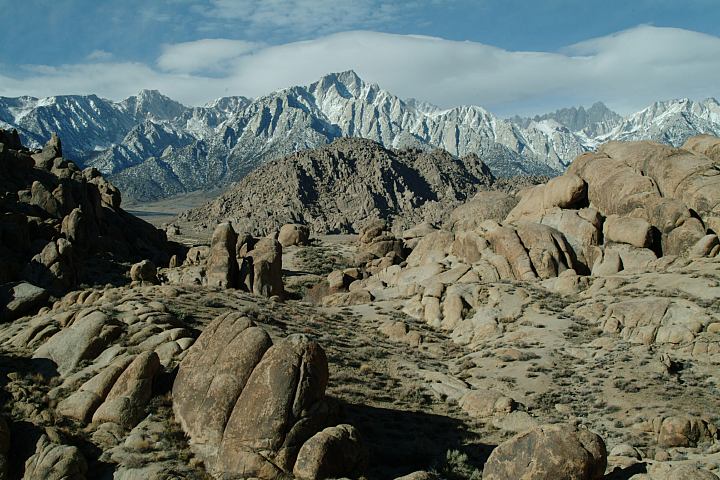
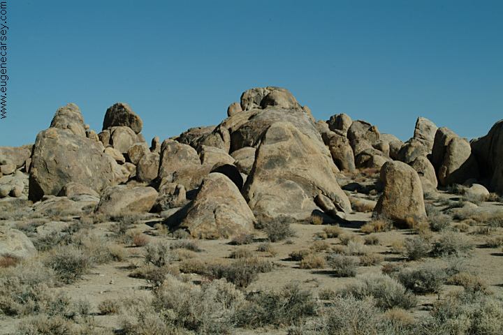
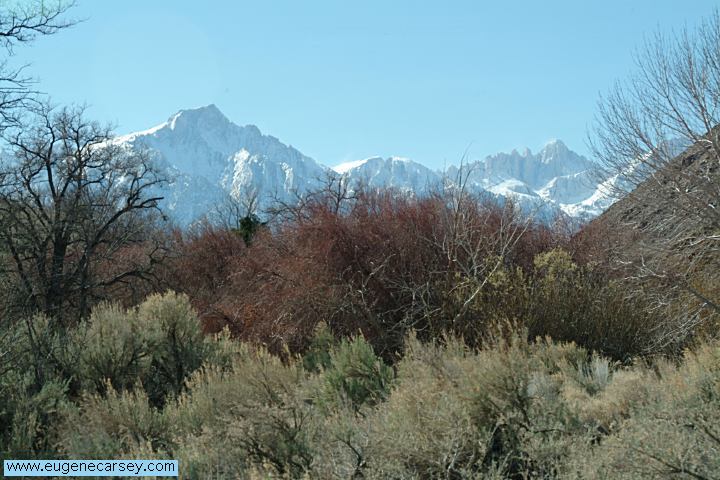
Extreme landscapes is a good description. |
|
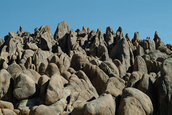
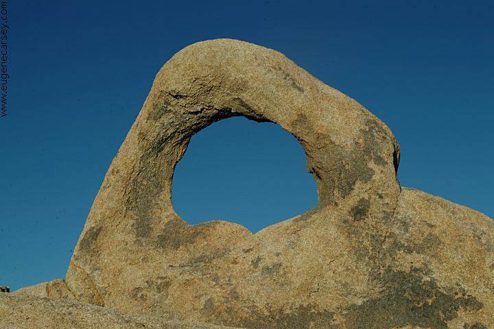
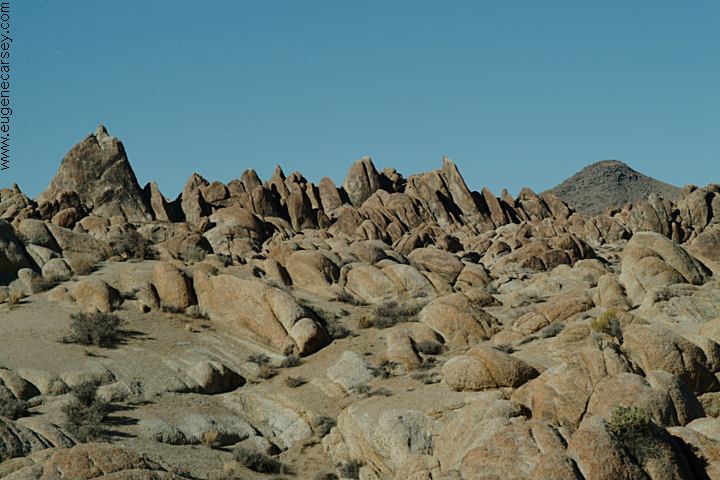
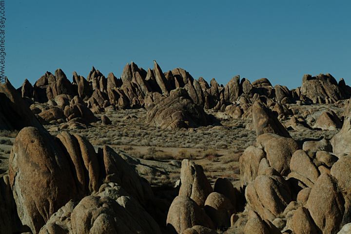
ARCHES OF ALABAMA HILLS |
|
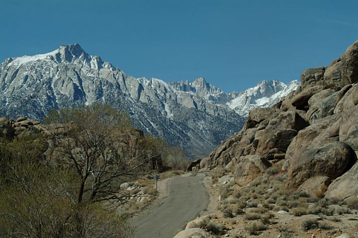
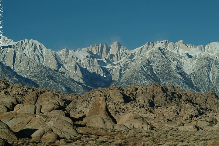
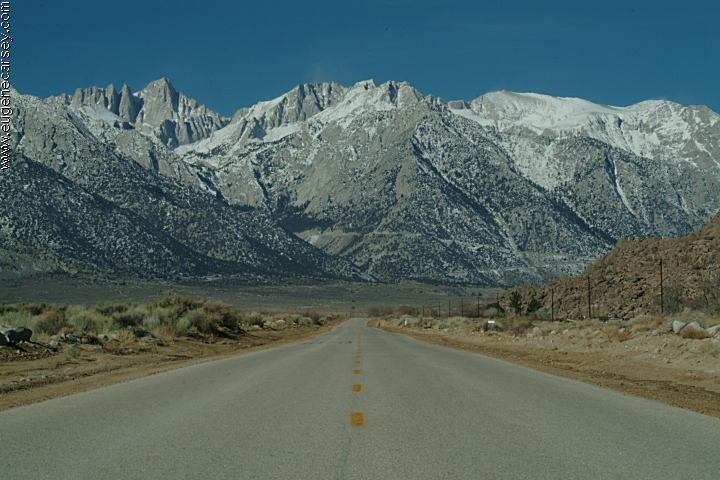
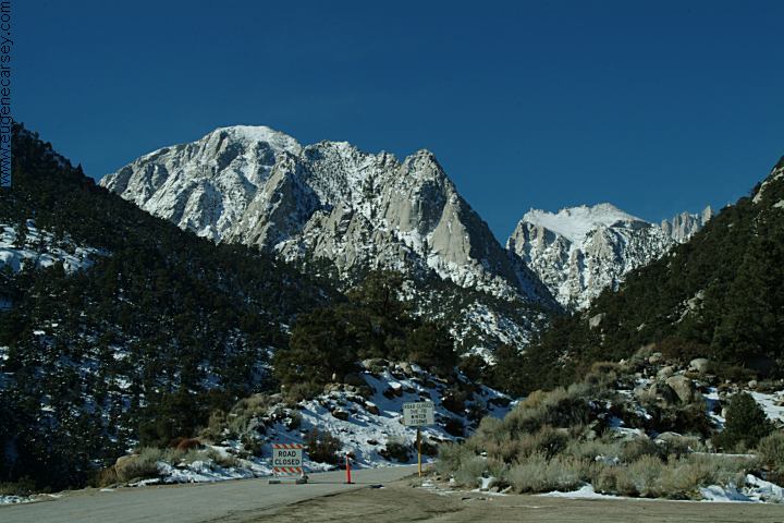
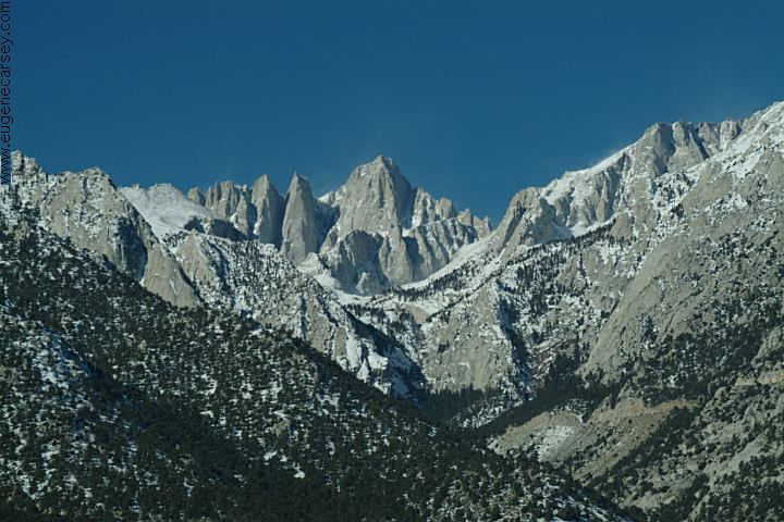
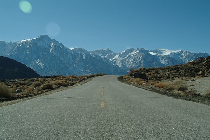
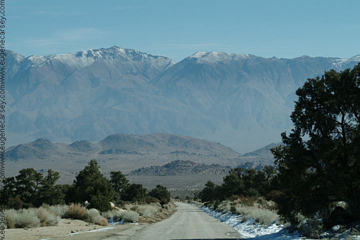
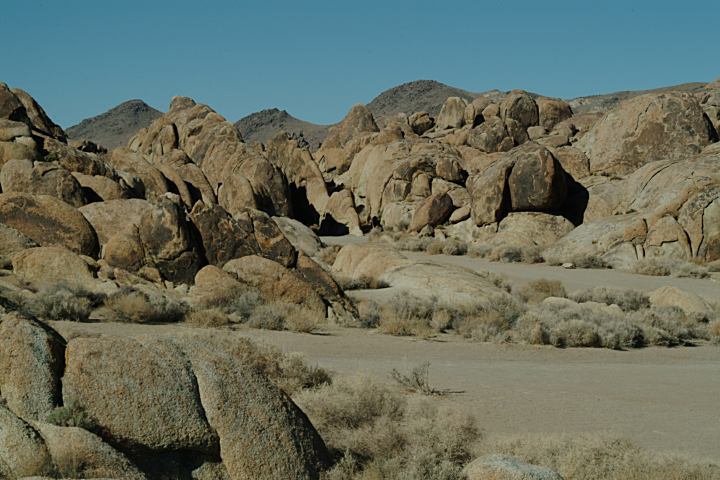
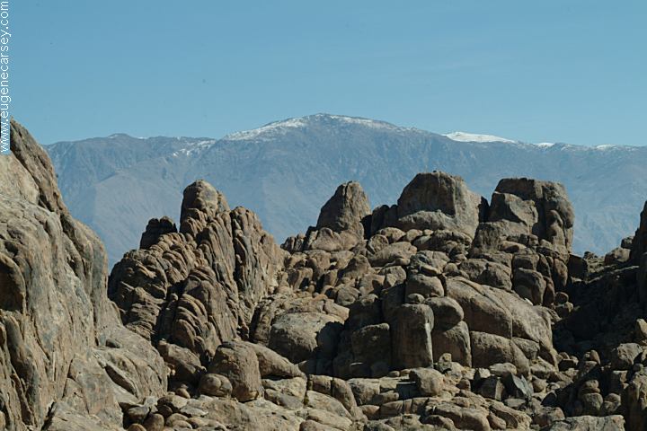
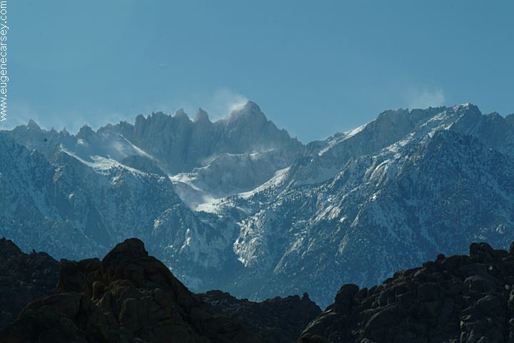
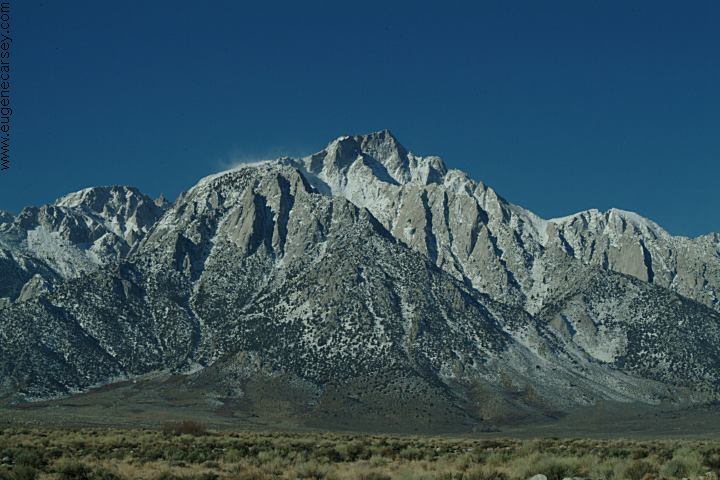
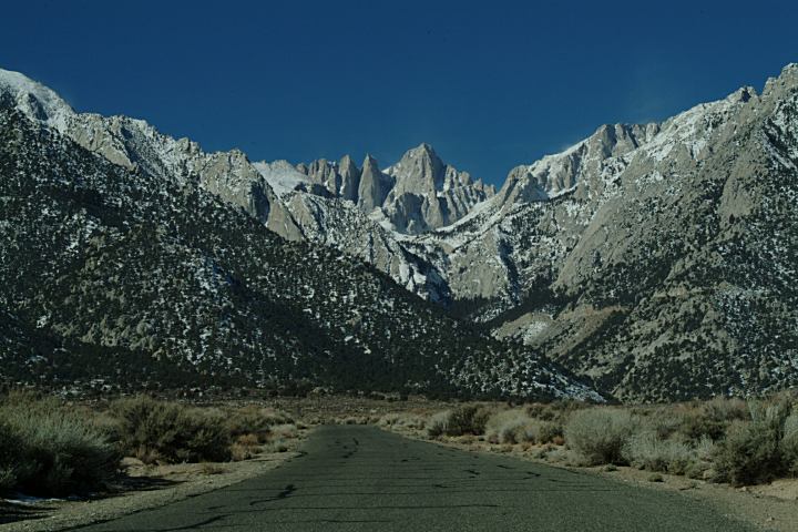
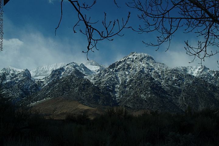
Incredible views of the Sierra Nevada Mountains, including Mount Whitney, the highest point in the contiguous United States.
|


|
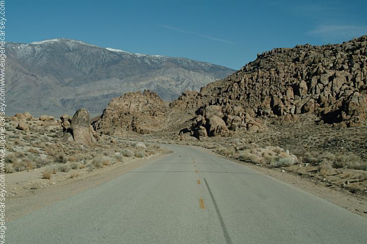
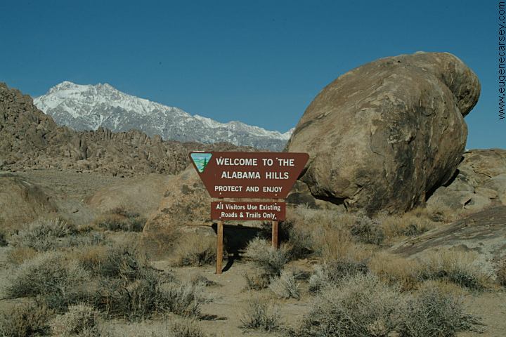
Alabama Hills were named in the 1860's during the Civil War by Southern sympathizers in honor of the Confederate warship CSS Alabama. The Alabama Hills Recreation Area was dedicated in 1969 by Bureau of Land Management and encompasses almost 30,000 acres.
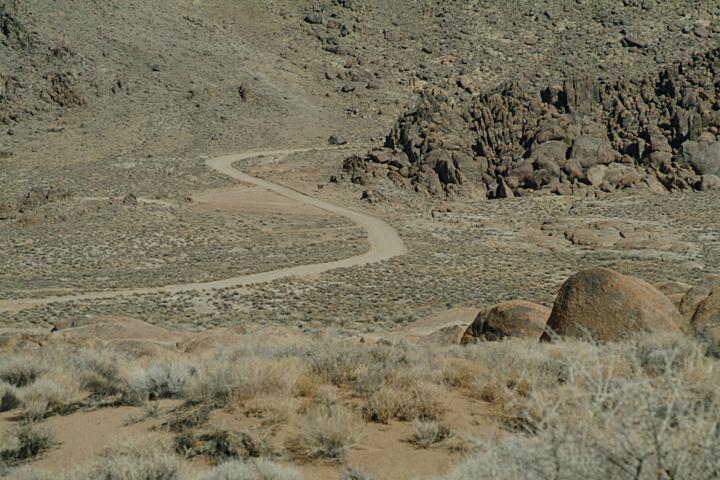
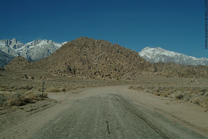
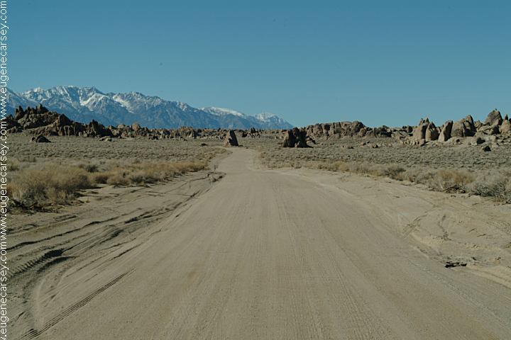
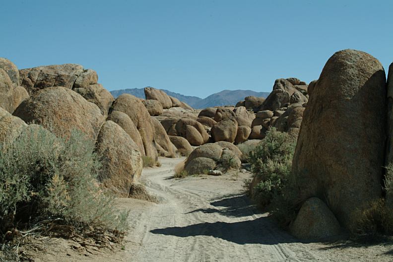
Roads wind through the rock formations. Vehicles must stay on established roads. |

|
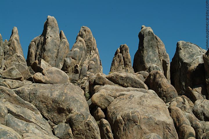
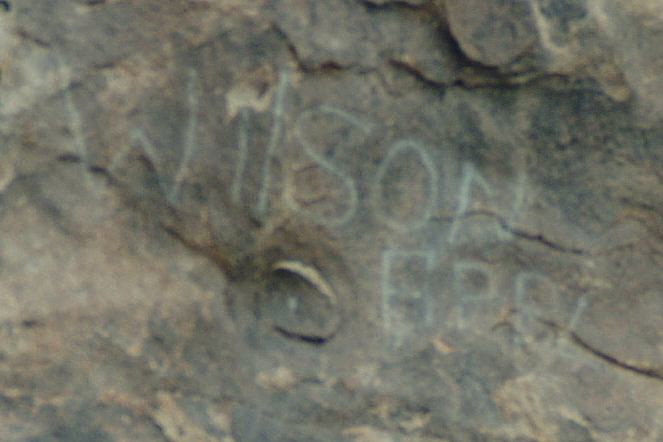
Besides natural arches and windows, there are several balanced rocks.
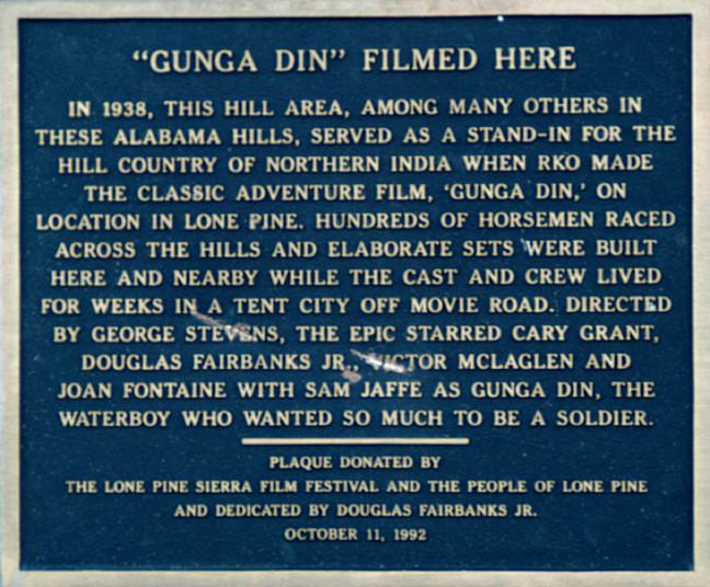
MOVIES FILMED IN ALABAMA
HILLS MOVIE LOCATIONS
IN ALABAMA HILLS
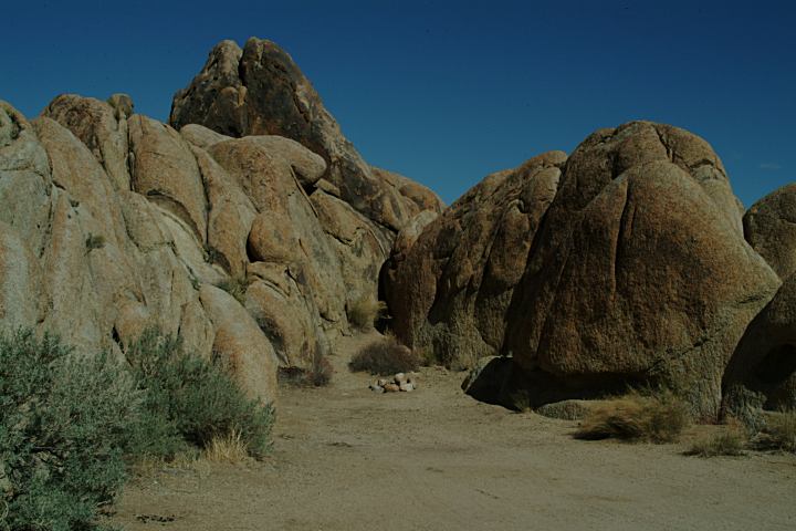
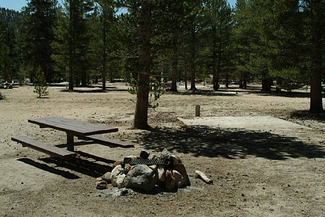
Continue past the historic plaque for "Gunga Din" and there is a great camp area hidden in the rocks. |

|
These camps are 1 1/4 mile north on Movie Road. Turn left towards the base of the hill. Every road this direction leads to a campsite.
MOUNTAIN PEAKS Lone Pine Peak 12,994'
PHOTO HERE
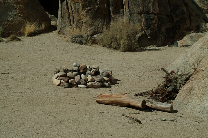
There's not much litter, mostly you find old cans and such. Found some coins from the 1960's and what appeared to be hardware from an old wagon. IT IS YOUR RESPONSIBILITY TO KNOW WHAT FIRE RESTRICTIONS ARE IN EFFECT. You need a CALIFORNIA FIRE PERMIT. Fire permits available for free at the Ranger Station. Shovel, axe and water required when dispersed camping. Leather gloves and fire extinguisher recommended.
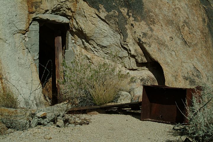
These are a couple caves / mines that have been turned into living quarters. Lots of garbage and junk around. Access from Tuttle Creek Road.
PHOTO HERE PHOTO HERE
|


|
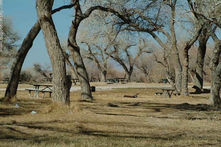
ESTABLISHED CAMPGROUNDS:
COTTONWOOD PASS WALK-IN C.G. COTTONWOOD LAKES WALK-IN C.G.
DIAZ LAKE RECREATION AREA HORSESHOE MEADOW EQUESTRIAN C.G.
LONE PINE CAMPGROUND
OAK CREEK CAMPGROUND
PORTAGE JOE CAMPGROUND
TABOOSE CAMPGROUND INYO
NATIONAL FOREST |
DIRECTIONS: ROAD CONDITIONS Summer temperatures can easily reach 100°F
with limited shade spots. The mornings are perfect, but by lunch time
you just want to find a good place to hide. The wind on the mountain peaks was reported to
be 120 miles per hour. Feb. 26, 2007 NOISE LEVEL: FLOWERS OF THE ALABAMA
HILLS LINKS: MILEAGE CHART: Drinking water at Diaz Lake or Portagee Joe
C.G. Most established campgrounds and recreation areas have good
drinking water. Showers at Rock Creek RV Park Showers at Diaz Lake??? There are solar
showers, but in bad shape and were closed in 2007??? Showers located in Big Pine, CA. Showers at Furnace Creek, Death Valley Wireless Internet connections at several
locations in Bishop or Mommoth. Best Grocery Store in Bishop, CA is Manor
Market on Hwy.168 west of town. (At the Shell Gas Station) Much cheaper
and fresher produce than the major food chains... KEELER,
CALIFORNIA DARWIN, CALIFORNIA MANZANAR NATIONAL HISTORIC SITE ANCIENT
BRISTLECONE PINE FOREST COTTONWOOD CHARCOAL KILNS
From Lone Pine, CA / Hwy.395
(At the only stop light in town)
Turn west on Whitney Portal Road
2 1/2 mile turn right on Movie Flat Road
(More camp areas towards Horseshoe Meadows)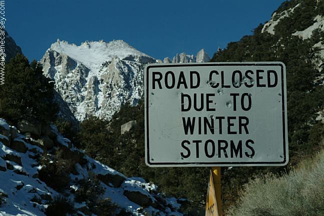
Whitney Portal Road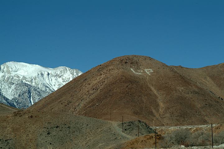
Lone Pine 2007
Whitney Portal Road is paved.
Dirt roads throughout Alabama Hills.
Mostly maintained with washboards.
RV's should stay on main roads. Snow not plowed in winter, but it
doesn't snow that much and usually
melts in a couple days.
About the only noises are from the birds and occasional military
planes... and then the exceptions, like some movie production doing
explosions. 
Scarlet Locoweed
Alabama Hills Recreation Area
March 10, 2007
A photo collection of wildflowers
Alabama Hills Recreation Area
http://www.lonepinechamber.org/
Lone Pine Chamber of Commerce
Includes a map of film locations...
http://www.owensvalleyhistory.com
Owens Valley History...
Lone Pine, CA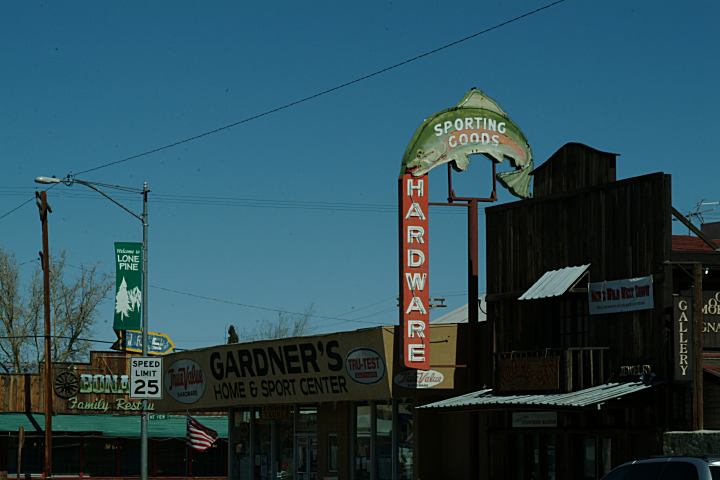
Lone Pine, CA
Mileage from Lone Pine, CA
Big Pine 40 miles
Bishop 54 miles
Reno, Nevada xx miles
Los Angeles, CA xx miles
Death Valley Museum 105 miles
Death Valley Junction 133 miles
Death Valley National Park is about 50 miles.
(About 3 miles south of Lone Pine)
Cost: $5.00
Buy token at the Mobile Gas Station.
Cost $3.50 for 10 minutes. 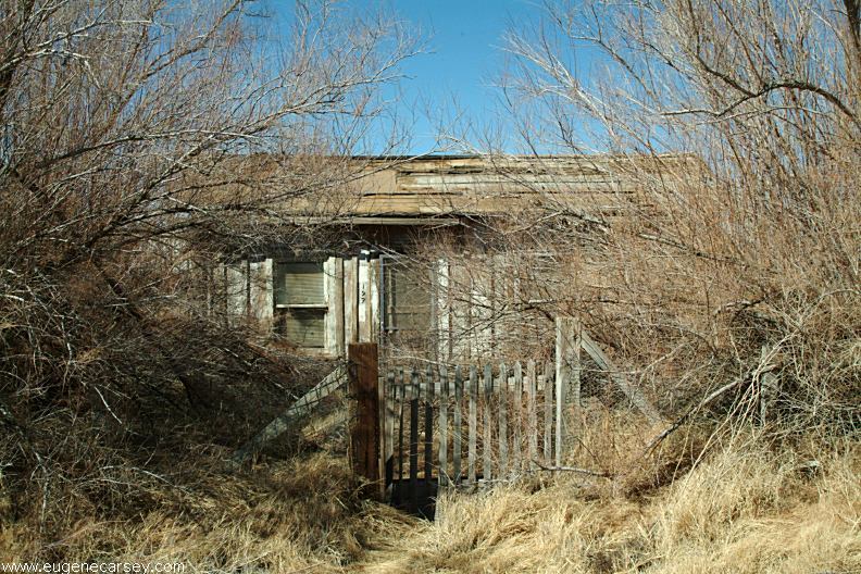
Old house in Keeler, CA
LATITUDE: N 36°29.309
LONGITUDE: W 117°52.403
Photos from Keeler, CA
Located on Hwy.136
13 miles east from Lone Pine, CA
What a bizarre town... a complete subculture.
Included under the listing for Ghost Towns.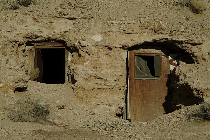
Underground House in Darwin, CA
Darwin is located a couple miles south of Hwy.190 (Just west of Death
Valley National Park). It could be listed as a Ghost Town, but people
live here. There are sections of interesting old company houses...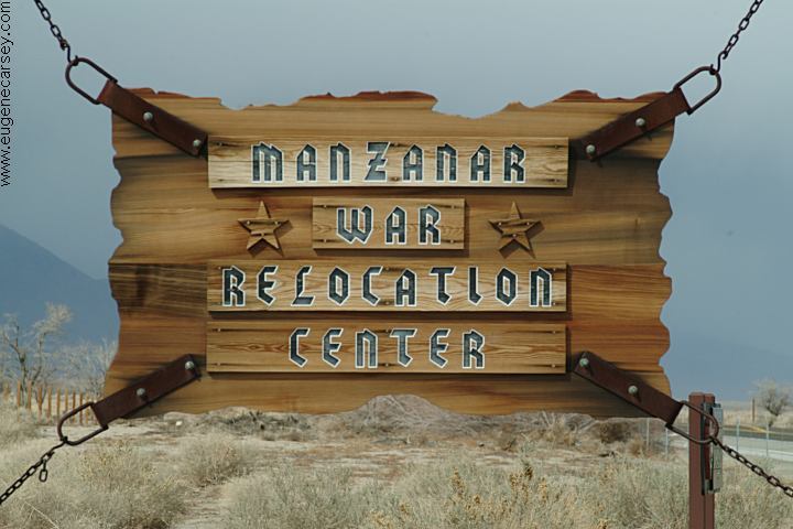
Manzanar National Historic Site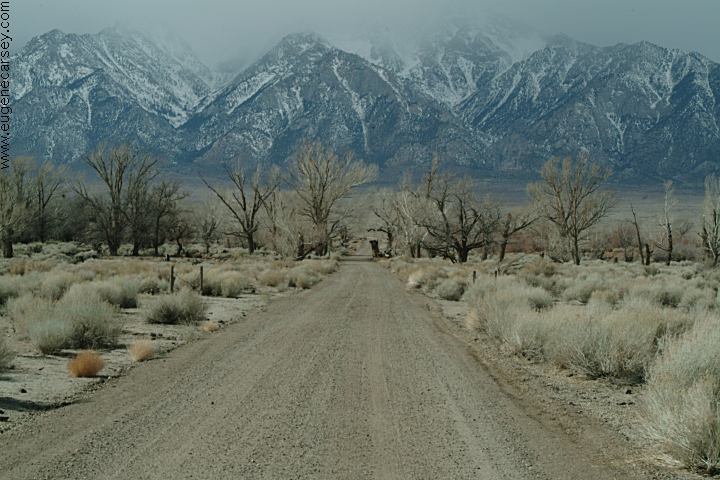
Manzanar National Historic Site
(9 miles north of Lone Pine, CA)
Manzanar was a Japanese Relocation Center during World War II. It is
one square mile and was enclosed with barb wire. It housed over 11,000
internees between March 1942 and November 1945.
N 36°43.553
W 118°08.719
Elevation 3853'
Manzanar Airport
Old and overgrown with weeds
Zurich Station
LATITUDE: N 37°11.023
LONGITUDE: W 118°15.708
Elevation: 3912'
Hwy.168 about 2 miles east of Big Pine, CA
Established 1884 as a freight and passenger station on the Carson &
Colorado Railway, know locally as "The Slim Princess", the station fell
into disuse during the 1940's and was abandoned when the Railway ceased
operation in 1960.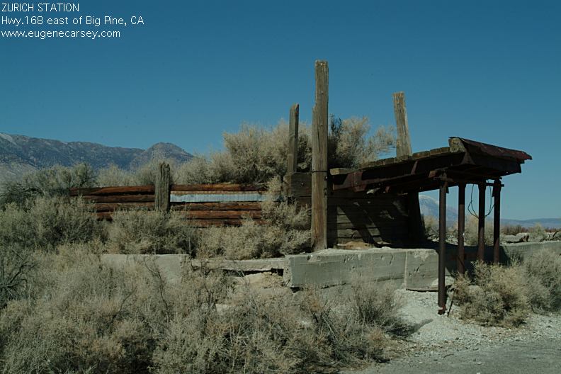
Zurich Station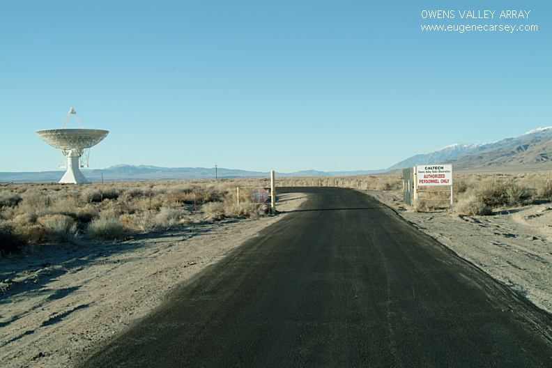
Owens Valley Array
(East from Big Pine, CA)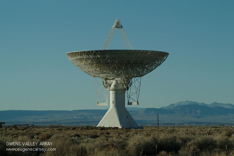
Owens Valley Array
(East from Big Pine, CA)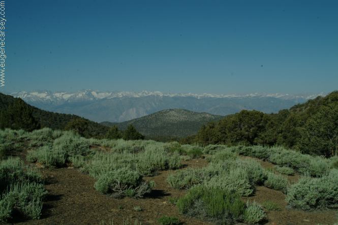
Bristlecone Pine trees are the oldest known
living things on earth at over 5000 years.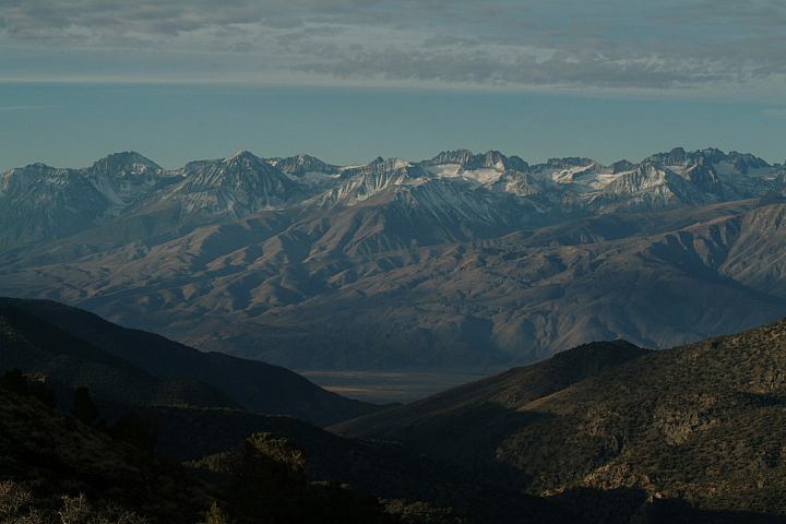
Sierra Vista Overlook on White Mountain Road
towards the Ancient Bristlecone Pine Forest
Take Hwy.395 north to Big Pine, CA
One of our favorites with incredible views of the Sierra Nevada
Mountains. Elevations above 10,000 feet.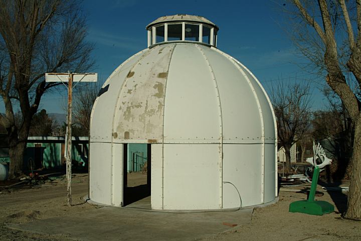
Space building in Cartago, CA
LATITUDE: N 36°19.146
LONGITUDE: W 118°01.608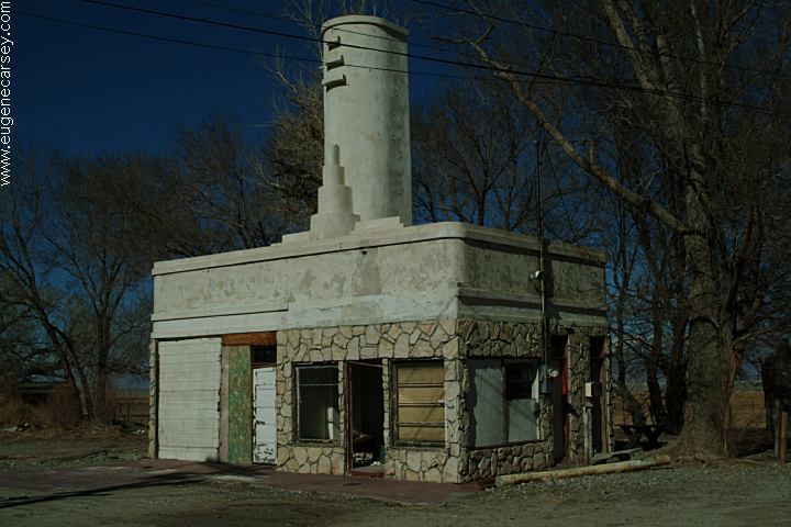
Olancha, CA
There are several old and abandoned buildings.
Hwy.395 at Junction of Hwy.190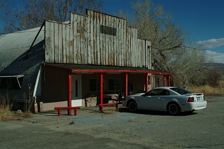
Olancha Store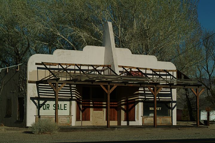
Olancha, CA
This building is about 2 miles south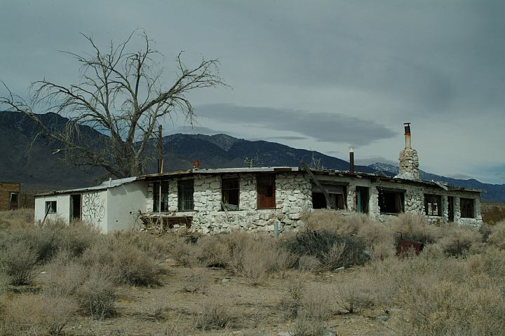
Buildings near Coso Junction
LATITUDE: N 36.05.278
LONGITUDE: W 117.57.599
(GPS opposite side of highway 395)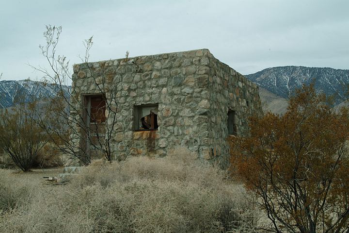
Buildings 36 miles south from Lone Pine.
3 miles north of Coso Rest Area on Hwy.395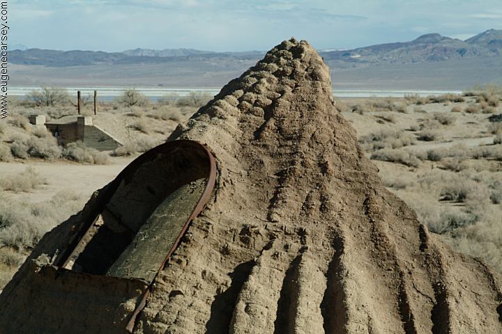
Cottonwood Charcoal Kilns
LATITUDE: N 36.24.910
LONGITUDE: W 118.00.717
Cottonwood Charcoal Kilns. From Lone Pine take Hwy.395 south about 11.5
miles. There is a small road marker. The charcoal kilns are to the east
about 1/4 mile.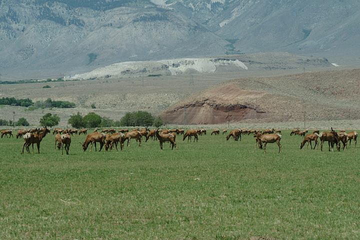
Elk at Wildlife Viewing Area on Hwy.395
Between Big Pine and Independence, CA
ARCHES OF ALABAMA HILLS ESTABLISHED CAMPGROUNDS: From the highest point in the contiguous
United States, Mt.Whitney at 14,496' to the lowest place, Badwater, at
nearly 282' below sea level, extreme landscapes abound, every road and
turn produces something new... DEATH
VALLEY NATIONAL PARK INDIAN GRINDING
STONES AND MORTARS CATTLE GRAVEYARD Don't know where to dump your asbestos? SALVATION MOUNTAIN Camped here Feb.20, 2007 CAMPGROUND INDEX dispersedcampgrounds.com
Photos, information, and directions about the Arches of Alabama Hills.
INYO NATIONAL FOREST
See: Inyo
National Forest Information
Includes photos and descriptions. 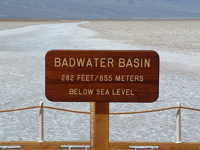
Badwater Basin
282 Feet Below Sea Level
Death Valley National Park
Photos and information about Death Valley.
Includes free Campground Directory.Also see: BAKER CREEK
Also see: BIG
SPRINGS
Also see: BRECKENRIDGE
Also see: BRISTLECONE PINE FOREST
Also see: BUTTERMILK
COUNTRY
Also see: CHIMNEY
PEAK
Also see: COTTONWOOD
CANYON
Also see: CROWLEY
LAKE
Also see: DEADMAN
C.G
Also see: DEATH VALLEY / SALINE
Also see: DEATH
VALLEY / WILDROSE
Also see: GLASS
CREEK
Also see: GOVERNMENT WASH
Also see: HARTLEY
SPRINGS
Also see: JAWBONE
ROAD
Also see: KEYESVILLE
ROAD
Also see: KIRCH
FLAT
Also see: LAKE
ISABELLA
Also see: PINE
CREEK
Also see: PV PIT
CAMPGROUND
Also see: SALT SPRINGS RESERVOIR
Also see: SHERMAN
PASS ROAD
Also see: TRONA
PINNACLES
Also see: WAGON WHEEL
Also see: WALKER
PASS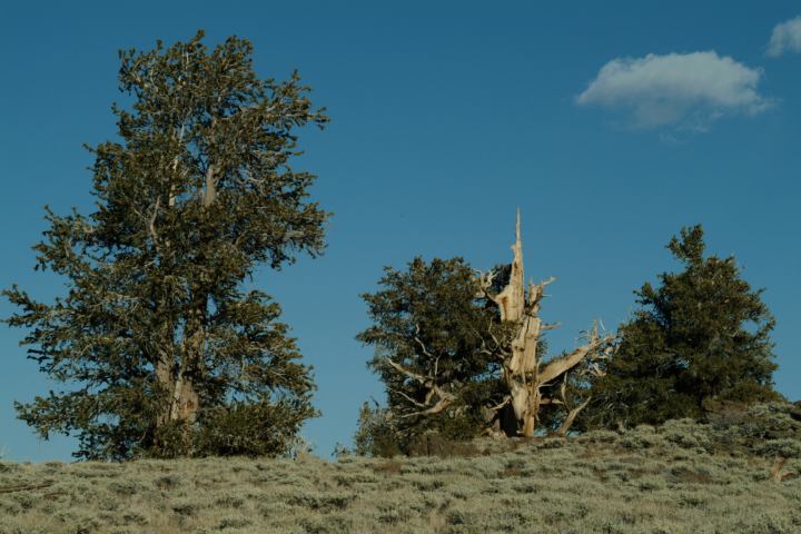
Bristlecone Pines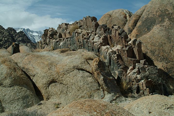
Natural Walls
Slime on Stream near Movie Road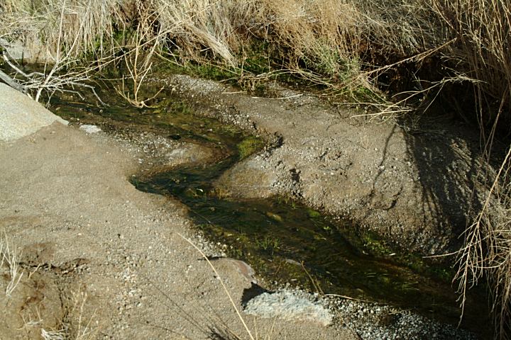
Stream near Movie Road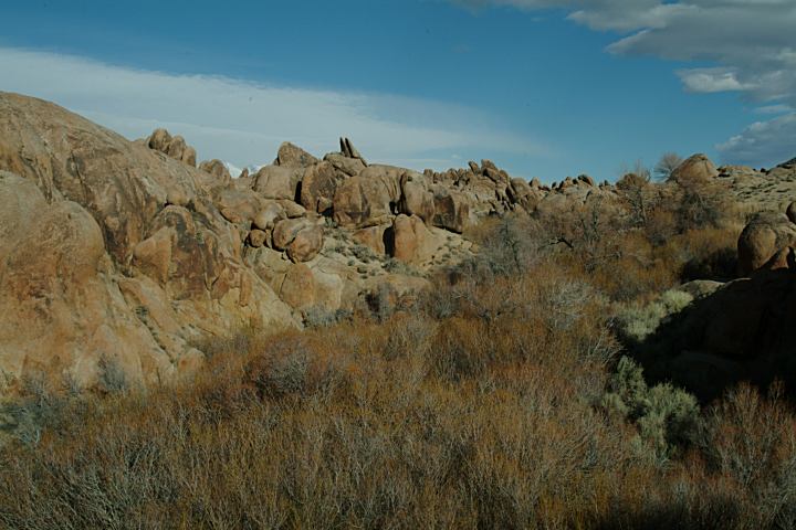
Creek Bed
Beavertail Cactus at Alabama Hills Recreation Area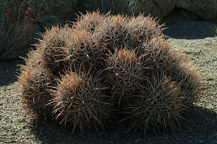
Cactus...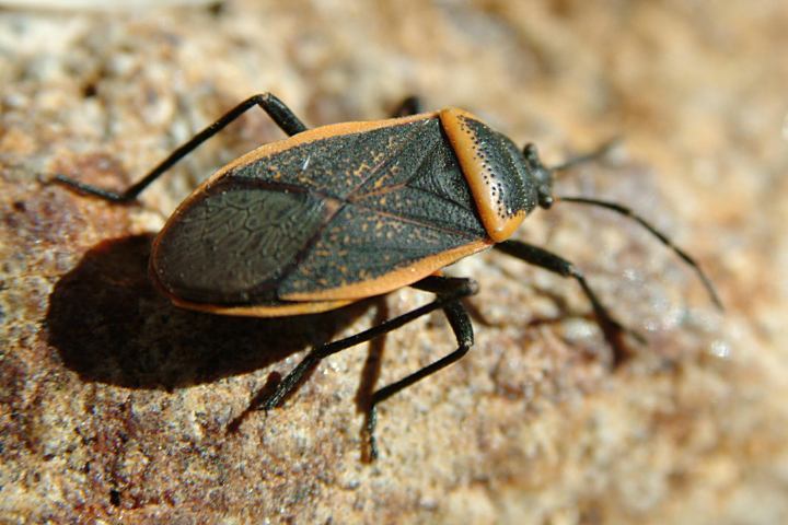
Insects and Bugs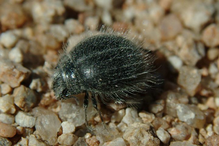
Insect and Bugs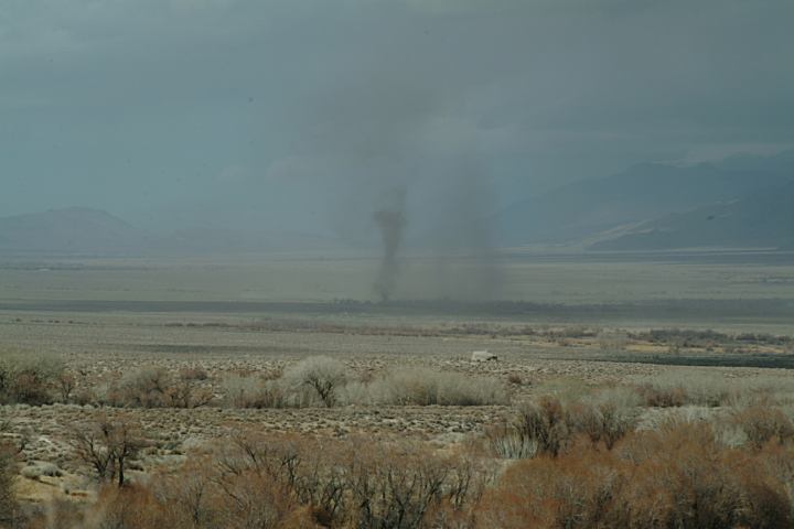
Dust Devils north of Alabama Hills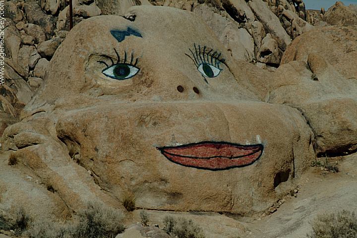
Face Rock on Whitney Portal Road
About 2 miles west of Lone Pine, CA
N 36°35.794
W 118°05.911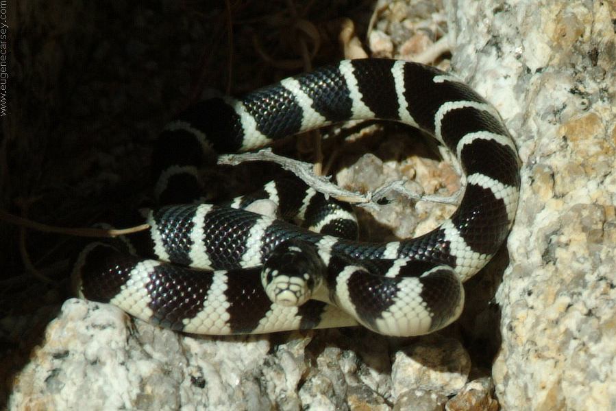
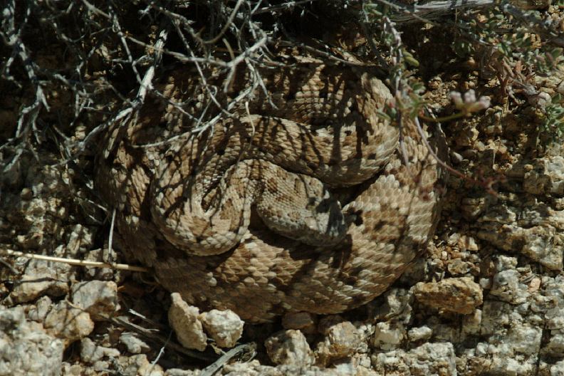
California Kingsnake (Lampropeltis getula)
Aggressive little snake. He assumed an attack
position and his tail switched back and fourth
like a rattlesnake without the noise.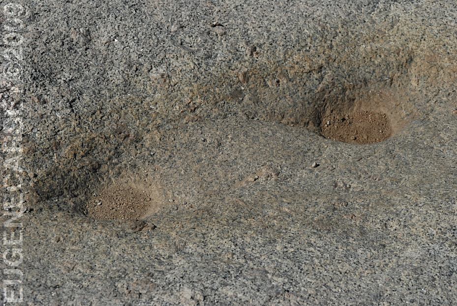
LATITUDE: N 36°36.177
LONGITUDE: W 118°04.470
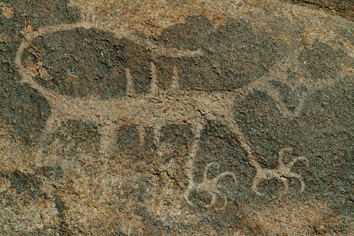
Grinding Rock with Dynamite Holes
Near the Information Kiosk on Whitney Portal Road.
You can find several Indian Mortars in the Alabama Hills and
surrounding area. 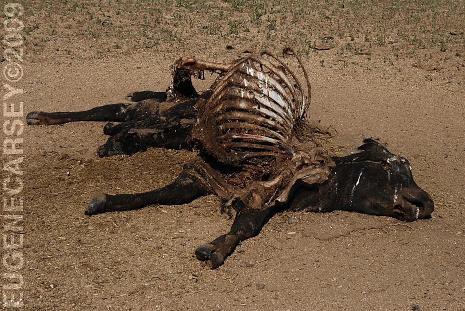
Cattle Graveyard
What a horrible sight to see...
There is a calf hanging out through the rib cage
and the hay from the stomach spilled out on the
ground.
LATITUDE: N 36°35.210
LONGITUDE: W 118°04.162
This is not an official Tourist Attraction.
Asbestos dumped in Alabama Hills...
Don't want to pay the high disposal fees?
Then dump your asbestos in the Alabama Hills.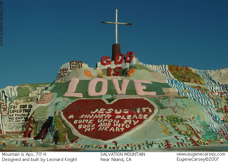
Salvation Mountain
Leonard Knight's Salvation Mountain
Take Hwy.111 south to Niland, CA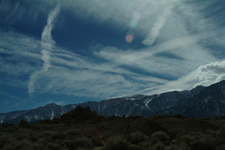
Funny Clouds over Alabama Hills.
Weather forecast was for sunny and clear skies.
Camped here April 28, 2008
Camped here January xx, 2009
Camped here March 15, 2009
Complete free campground listing
Free campgrounds and camping
CALIFORNIA CAMPGROUNDS
SIERRA NEVADA MOUNTAINS
MOUNT WHITNEY PORTAL
ALABAMA HILLS RECREATION AREA
