|
ARCHES OF ALABAMA HILLS There are hundreds of natural arches throughout |
MOBIUS ARCH LATHE ARCH EYE OF
ALABAMA HEART ARCH WHITNEY
PORTAL ARCH EAGLE EYE ARCH ONE MILE ARCH NORTH SENTRY
ARCH HITCHING
POST ARCH FISH ARCH DUCK ARCH SPARK PLUG ARCH NATURAL
BRIDGE COMPLETE
LIST OF ARCHES DISCLAIMER: The best way to find the arches is by walking Alabama Hills were named in the 1860's during Incredible views of the Sierra Nevada
Mountains, ALABAMA HILLS
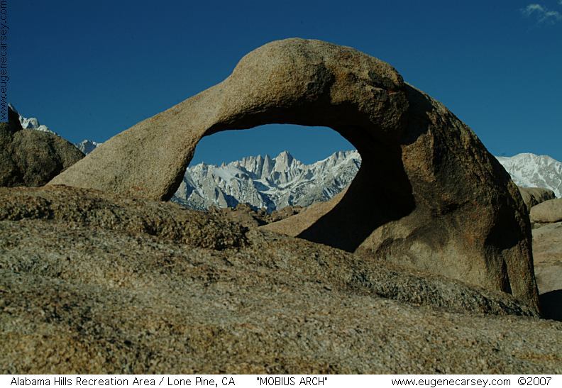
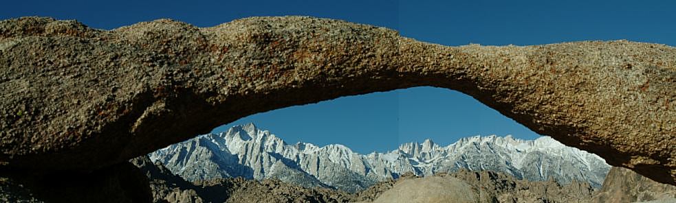
Mobius Arch
Arch with framed view of Mount Whitney.
Probably the most photographed arch in the
Alabama Hills. This Arch is just east from
Lathe Arch.
Lathe Arch is next to Mobius Arch.
See panorama image on top of this page.
Eye Of Alabama
From Heart Arch, continue northbound on
Movie Road through the curves. Take the
first road left and halfway up the hill. Eye
of Alabama is towards the right.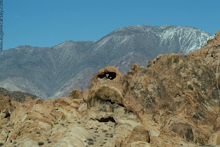
Heart Arch from Movie Flat Road
Take Movie Flat Road 1 1/2 mile
Stay right at the Y in the road
From the first pull-out on the left,
you can see the Heart Arch.
There are more arches in this area.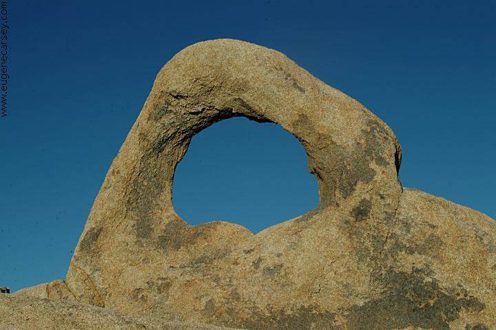
Arch Off Whitney Portal Road
ARCH OFF WHITNEY PORTAL ROAD
Also referred to as Western Arch
From Lone Pine take Whitney Portal Road
5.3 miles. Turn right on the dirt road and
park near the fence. Walk across the wood
bridge over Lone Pine Creek and follow the
trail going west. Walk about 10 minutes and
Whitney Portal Arch can be viewed to your
right about half way up the hillside.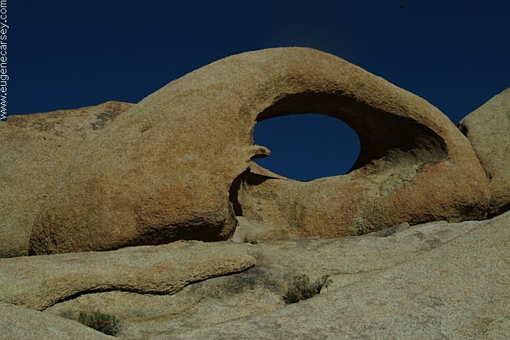
Eagle Eye Arch
From the junction of Whitney Portal Road
and Movie Road, Eagle Eye Arch is south,
against the distant hillside. 
One Mile Arch
The name is because it is 1 mile on Movie Road.
Turn right and there is a junction about 200 feet.
Arch is about 100' to the southeast.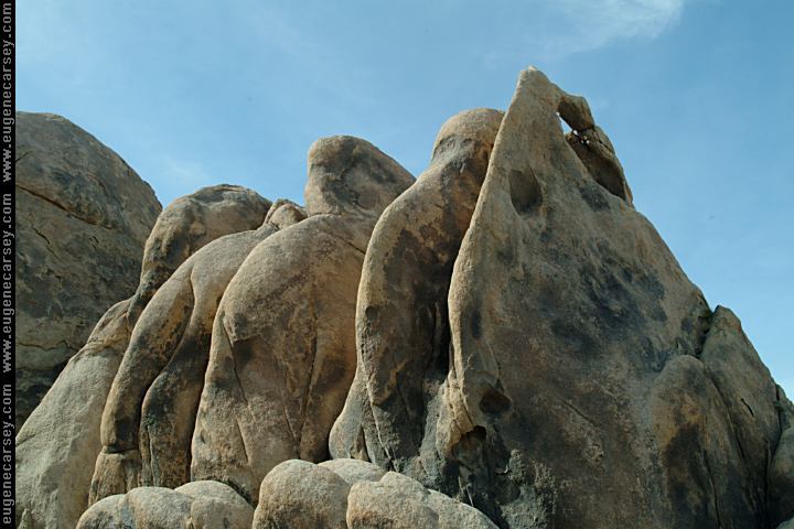
North Sentry Arch
Giant slabs of granite keeping watch over
the northern section of Alabama Hills
Recreation Area.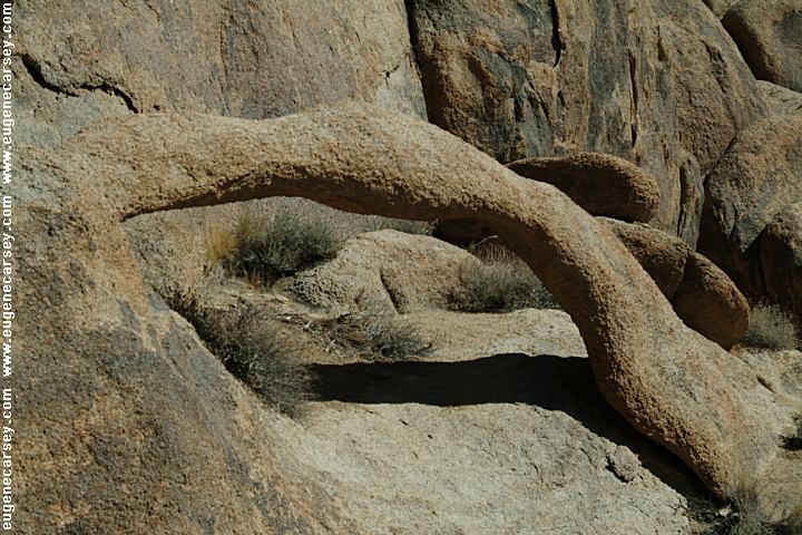
Hitching Post Arch
It looks like a hitching post. In the same
grouping as the Three Surfers. Best photos
in the afternoon.
Fish and Duck Arch
On Tuttle Creek Road on the north...
On the north side of road. There is a wide
shoulder to a park vehicle. Pumpkin shaped
rock towards the east.
See Fish Arch...

Spark Plug Arch
Just east from Arches on Tuttle Creek Road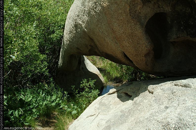
Natural Bridge (Tuttle Creek Arch???)
There is a stream flowing
under arch.
This is the complete listing of natural arches
in the Alabama Hills Recreation Area that we
have listed.
We have tried to research the actual names of
individual arches with limited success. At the
present time most of the names used for each
arch on this page are used as a temporary
reference. Cataloged names of arches will
be the UTM coordinates.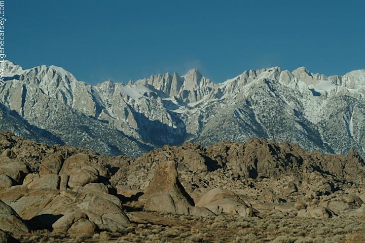
Alabama Hills and Sierra Nevada Mountains
Mount Whitney in center at 14,497'
around the rock formations. The arches blend
in with the surrounding rocks.
the Civil War by Southern sympathizers in honor
of the Confederate warship CSS Alabama. The
Alabama Hills Recreation Area was dedicated
in 1969 by Bureau of Land Management and
encompasses almost 30,000 acres.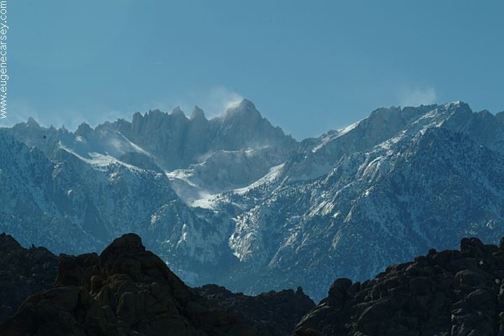
Mount Whitney 14,497'
including Mount Whitney, the highest point in the
contiguous United States.
Photos included on the free campground
directory for Alabama Hills Recreation Area.
DIRECTIONS: ROAD CONDITIONS MILEAGE CHART: LINKS: FLOWERS OF THE ALABAMA
HILLS
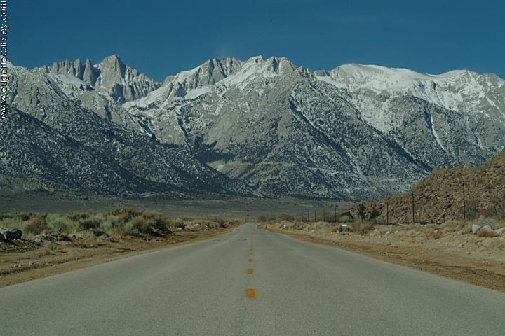
Whitney Portal Road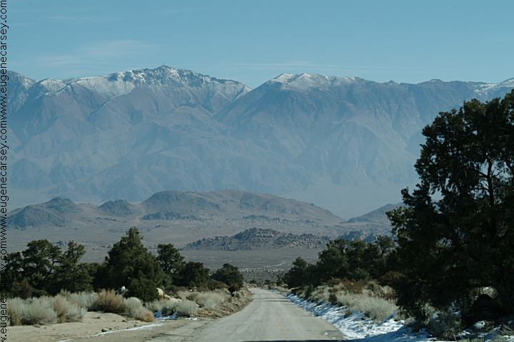
Whitney Portal Road towards Lone Pine, CA
Alabama Hills in the Valley Area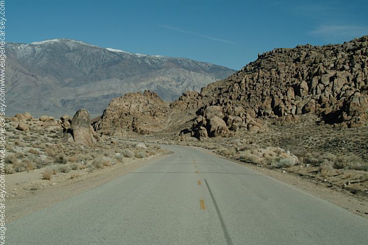
Whitney Portal Road towards Big Pine, CA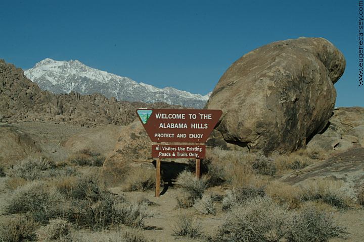
Sign at Alabama Hills Recreation Area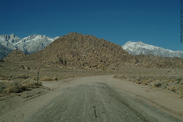
Movie Flat Road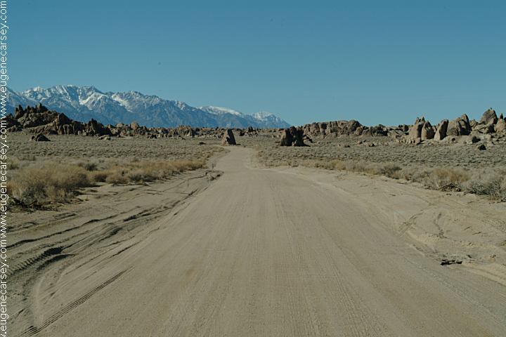
Movie Flat Road
From Lone Pine, CA / Hwy.395
(At the only stop light in town)
Turn west on Whitney Portal Road
Movie Flat Road 2 1/2 mile
Horseshoe Meadows Road 3 miles
Whitney Portal Road is paved.
Dirt roads throughout Alabama Hills
Mostly maintained with washboards.
Mileage from Lone Pine, CA
Big Pine 40 miles
Bishop 54 miles
Reno, Nevada xx miles
Los Angeles, CA xx miles
Death Valley 103 miles
Death Valley National Park is about 50 miles.
Beavertail Cactus at Alabama Hills Recreation Area
http://users.sisna.com/archman/AlabamaHills.html
Bob's Arches has extensive list of arches
with photos and information..
www.naturalarches.org
The Natural Arch and Bridge Society.
www.isaczermak.com/california-alabama-hills.html
Nature Photography by Isabel Synnatschke
Alabama Hills Photo Gallery and Travelogues 
Scarlet Locoweed
Alabama Hills Recreation Area
March 10, 2007
A photo collection of wildflowers
Alabama Hills Recreation Area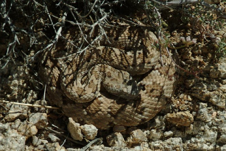
Rattlesnake at Alabama Hills Recreation Area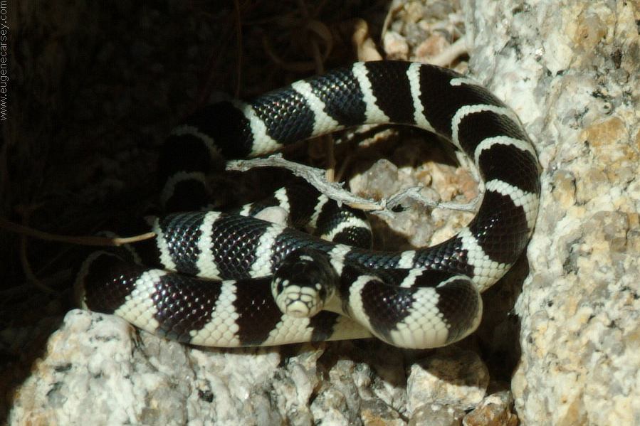
Aggressive little King Snake. He assumed
an attack position and ready to strike.
MORE PHOTOS OF
ALABAMA HILLS MOVIES FILMED IN ALABAMA
HILLS MOVIE LOCATIONS
IN ALABAMA HILLS INDIAN GRINDING
STONES AND MORTARS CATTLE GRAVEYARD KEELER,
CALIFORNIA COMPLETE
LIST OF ARCHES CAMPGROUND INDEX dispersedcampgrounds.com
Photos included on the free campground
directory for Alabama Hills Recreation Area.
Several movies have been filmed in this area,
including Gunga Din, The Lone Ranger, ect...
Locations of movies filmed in the Alabama Hills.
Locations have been matched with images from
the movie. Directions to help find the locations.
Included are GPS coordinates and satellite photos. 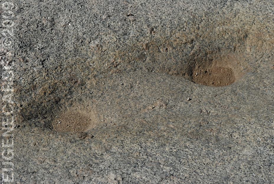
LATITUDE: N 36°36.177
LONGITUDE: W 118°04.470
Grinding Rock with Dynamite Holes
Near the Information Kiosk on Whitney Portal Road.
You can find several Indian Mortars in the Alabama
Hills and surrounding area. 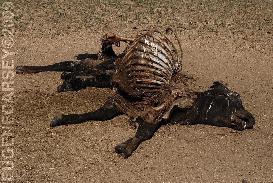
Cattle Graveyard
What a horrible sight to see...
There is a calf hanging out through the rib cage
and the hay from the stomach spilled out on the
ground.
LATITUDE: N 36°35.210
LONGITUDE: W 118°04.162
This is not an official Tourist Attraction.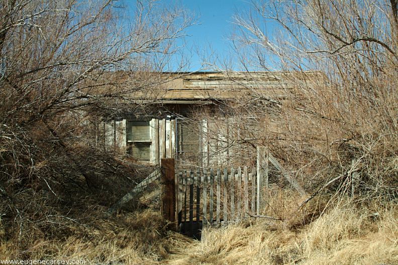
Old house in Keeler, CA
Photos from Keeler.
Located on Hwy.136
13 miles east from Lone Pine, CA
What a bizarre town... a complete subculture.
Included under the listing for Ghost Towns.
This is the complete listing of natural arches in the
Alabama Hills Recreation Area that we have listed.
Complete free campground listing
California Tourist Guide and Destinations
Things to do and see in California
ALABAMA HILLS RECREATION AREA
NATURAL ARCHES
