|
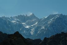
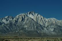
WHITNEY
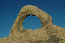
PORTAL ARCH
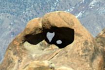
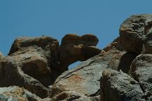
HEART ARCH BEHIND HEART
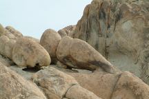
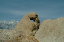
ARCH LATHE ARCH MOBIUS ARCH SHARK TOOTH
ARCH MOVIE ROAD ARCH |
|
EYE OF
ALABAMA
GRANDFATHER
ARCH SHADOW ARCH
|
GUNGA DIN ARCH WEST GUNGA
DIN ARCH WEST GUNGA
DIN ARCH 2 SOUTH OF GUNGA DIN EAGLES HEAD ARCH HELLS GATE ARCH RABBIT ARCH
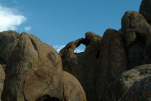
Gunga Din Arch
Arch viewed from Plaque at Gunga Din Historic Site
Viewed from the Gunga Din Historical Marker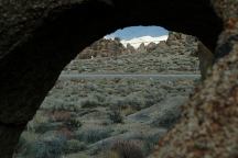
West Gunga Din Arch
Arch across the road from Gunga Din Historic Site.
Gunga Din Marker on other side of Horseshoe Road
Across the road from the Gunga Din Historical Marker. A little towards the north...
Directly across the road from the Gunga Din Historical Marker. Low profile and hard to see.
We viewed this arch from across the road, but went to search for it and couldn't find the arch. The arch had about a 3' opening.
Hidden in the rocks north of Gunga Din Arch.
From the Gunga Din Plaque follow the dirt road east. Hells Gate Arch on the right side.
Hidden behind Hells Gate Arch
LONESOME ARCH EAGLE EYE ARCH UNKNOWN ARCH THE PINCHERS ARCH
From Whitney Portal Road turn south on Horseshoe Meadow Road. About 1/4
mile it is in the flatlands looking east. There is a barbwire fence you
have to cross from this direction.
From the junction of Whitney Portal Road and Movie Road Eagle Eye Arch is about due south against the distant hillside.
From Eagle Eye Arch it is to the southeast up in the rock formations.
From Lonesome or Eagle Eye Arches you can see the Pinchers to the south.
BRENA ARCH OLD TOM ARCH ONE MILE ARCH ARCH 4731 LAUGHING ARCH GRIM ARCH CITY OF
ARCHES SILLY ARCH ELUSIVE ARCH KEITH ARCH WINDOW ARCH LOST ARCH
Near the City of Arches
Southwest from Brenna Arch
The name is because it is 1 mile on Movie Road. Turn right and there is
a junction about 200 feet. Arch is about 100' to the southeast.
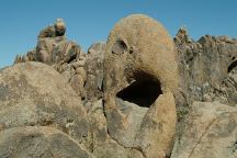
Just seemed to be laughing and in good spirits.
This poor arch is the opposite of Laughing Arch
These small arches are everywhere throughout this area that are like a city designed by Dr. Seuss.
(Contortion Arch)
Small sized arch...
Can be viewed from the petroglyphs looking east. This arch is hard to find and in a tangle of rocks.
20' length with double openings.
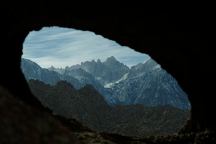
Framed mountain view
Somewhere in the area of Petroglyph Arch???
RANCHERS ARCH RANCHERS ARCH
No.2 RAM HEAD ARCH GRAFFITI ARCH CAMP THREE ARCH CAMP FOUR ARCH CAVE ARCH TARA ARCH ARCH 2610 ARCH 2611 ARCH 2612
After turning on Movie Road drive 1/2 miles and turn west towards the rock formations.
Just behind Ranchers Arch on the north side.
Take Movie Road .7 miles and turn west.
Park at the first turn out on the left and Zoe Arch is about 20' south in a ravine.
Take
Movie Road about .7 miles and Graffiti Arch is to the west. There is
oval shaped opening that is most impressive closer to the arch.
This arch is 1 1/4 miles north on Movie Road. Turn left and arch is at
base of the hills. First photo is from our campsite. This was our third
campsite...
Camp 4 Arch doesn't look like much from a distance, but upon closer
inspection, it turned out to be respectable in form and size.
Reading the Tourist Guide, you would think this is a big cave. Really
is just a hole in the rock (9' x 9' floor). There is a window, like a
little house.
This arch is like an angle in the sky. 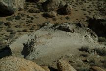
White Arch (Viewed from the top)
BOOT ARCH DOUBLE ARCH WITH
WINDOWS FACTORY ARCHES BIG DADDY ARCH BIKINI TOP ARCH STEVENSON ARCH
HORSE WITH FOOT IN MOUTH???
(Movie Road north of Alabama Hills)
1/5 mile before the north entrance of
Alabama Hills turn south on the spur
road and park at the first turnout You
will see Boot Arch
This is a double arch with several windows. There are several names for
this arch, including Cyclopes, ect... Those could also be two fangs of
a giant spider or tick's head.
There are several small arches in the same area as Boot Arch and Double Arch.
Towards the north section of Alabama Hills.
On the east side of Movie Road.
It's only a rock...
Also called Sea Monster Arch
NORTH SENTRY
ARCH LITTLE TINY
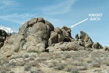
ARCH QUAIL HEAD ARCH CUTE ARCH SIX INCH ARCH KNIGHT ARCH MULTIPLE ARCHES ORANGE ARCH
LOST COOKIE
ARCH QUARTZ ARCH FUNNY FACE ARCH ASTRONOMER ARCH JOINT ARCH
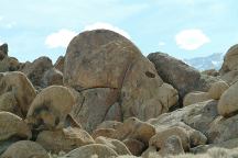
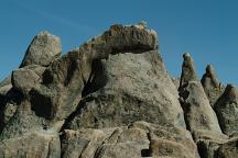
Giant slabs of granite keeping watch over the northern section of Alabama Hills Recreation Area.
Small arch that stands out in a crowd.
Looks like a quail head from certain directions
In the rock formation with the door knob. There is a hawk's nest near the arch, so don't disturb.
About 6" long tubular shaped arch...
If you play chess then you know the piece shaped like a horse head...
Small and less attention
The north side of this arch is covered with an orange lichen.
Cookie the Dog... lost in the desert on a hot summer's day and survived.
Lots of quartz, including some crystals
Funny Face Arch can only be viewed from this direction.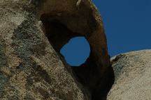
Astronomer Arch
A telescope pointed towards the stars...
Framed views of Sierra Nevada Mountains.
RAVEN ARCH 2 DORIS ARCH STAND ALONE ARCH SUBMARINE ARCH SMART ARCH CACTUS ARCH ARCH IN AN ARCH ARCH 5561 ARCH 72815 ARCH 8817 AARON OLIVER ARCH DOG ARCH SNAP ARCH BABY ARCH 2
Hard to find. Below ground level in a wash.
(New 0028 Arch)
The complete rock formation shaped like a German U-Boat???
Smarter than some people...
Several small arches in the area.
Just west of Cactus Arch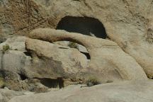
Gilbert Arch
Along side of Movie Road...
Framed views of surrounding mountains.
(ARCH 8818)
Shaped like a dog head... maybe a bengal.
Fingers ready to snap...
Cute as a baby and about the same size.
LIFEGUARD ARCH THREE SURFERS
(Surfer No.1) THREE SURFERS
(Surfer No.2) THREE SURFERS
(Surfer No.3) HITCHING
POST ARCH UNKNOWN ARCH #2 CRAGGY ARCH EYE BROW ARCH KID ARCH DOMINO ARCH THREE SLABS BABY ARCH Z ARCH ARCH 445 ARCH 446 ARCH 447 BASEBALL ARCH
Keeping a watch over the Three Surfers.
There is a rock that resembles a ocean wave and the arches are the surfers.
There is a rock that resembles a ocean wave and the arches are the surfers.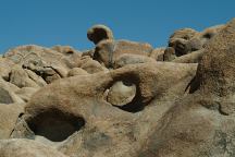
Surfer No.3 with wave in background.
There is a rock that resembles a ocean wave and the arches are the surfers.
It looks like a hitching post. In the same grouping as the Three Surfers. Best photos in the afternoon.
Just south of the Hitching Post
There are two main arches in this rock formation and several small arches.
Just east and across the road from Craggy Arch.
Small but growing in size.
(No photos at present time)
Domino Arch is the shape of a large domino.
(Sandwiched Arch???)
The arch is in the middle slab. Same area as the Domino.
From the photos it looks large, but that is a deception, as it is only 2 1/2 feet in length.
GPS and Measurements???
GPS and Measurements???
GPS and Measurements???
About the size of a baseball, but really needs a different name.
LITTLE HEART
ARCH LONE PINE ARCH LONE PINE ARCH NEIGHBORS CATS EYE
Just west from Face Rock is Little Heart Arch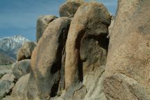
Side view of West Face Rock Arch
Lone Pine Arch is northeast from the junction of Whitney Portal Road and Movie Road. Best photos in the morning.
There are several little arches in the rock formation just southeast of Lone Pine Arch
To the northeast of Lone Pine Arch you can see the Cats Eye...
FORTRESS OF ARCHES TELEPHONE ARCH BIRD MASK ARCH BOTTOM ARCH ARCH 7110 ARCH 7112 SUNSET ARCH
(ARCH 7114) ARCH 7116 ARCH 7124 JIGSAW
PUZZLE ARCH
BIRD MASK ARCH 3 COUGAR HEAD
ARCH BEHIND
COUGAR HEAD ARCH INDIAN HEAD
ARCH SOUTH OF
INDIAN HEAD ARCH CHINOOK ARCH
Take Whitney Portal Road 2 miles west from Lone Pine and you will see
Face Rock on the right. There are a several arches on the south side of
Whitney Portal Road.
Located in Fortress of Arches Canyon
Located in Fortress of Arches Canyon. There are two separate arches forming the Bird Mask Arch.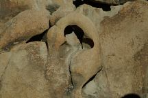
Bottom Arch (Fortress of Arches)
Located in Fortress of Arches Canyon
Located in Fortress of Arches Canyon
Located in Fortress of Arches Canyon
Sunset Arch
(Arch 7114 with sunset in background)
Located in Fortress of Arches Canyon
Located in Fortress of Arches Canyon
Located in Fortress of Arches Canyon
No photos included for Arch 7124
Located in Fortress of Arches Canyon
A combination of three separate arches
Located to the west of Fortress of Arches
If you climb up and behind Cougar Head is a large arch hidden in the rock formation. No photos at the present time.
Located on the south side of the hill from Fortress of Arches Canyon
Just south from Indian Head Arch
West of Indian Head Arch
HOP-A-LONG CASSIDY ARCH TUTTLE CREEK
ARCH FAKE ARCH AND REAL ARCH CAVE HOUSE ARCH KNEE JOINT ARCH HIPPIE CAVE
ARCHES FISH ARCH DUCK ARCH SPARK PLUG ARCH ARCHES
ON TUTTLE CREEK ROAD SECRET ARCH ARCH ON SUNSET DRIVE SQUEEZED ARCH KKK ARCH
ARCH 78281
SKY ARCH BUTCH ARCH SNOOKS ARCH ARCH 704077 ARCH 626136 DISCLAIMER:
No photos or details at present. Arch is on Tuttle Creek Road near Hop-A-Long Cassidy cabin. (Private Property)
"NATURAL BRIDGE"
The original name we heard was Tuttle Creek Arch but this arch doesn't span Tuttle Creek.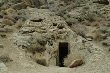
Cave House
(No photos of the arch)
No photos of the actual arch, which is located on the left and about 100' up the hill.
Looks like a big knee bone. Probably the rock itself is more interesting than the arch...
Near the Hippie Caves...
On Tuttle Creek Road on the north...
On the north side of road. There is a wide shoulder to a park vehicle. Pumpkin shaped rock towards the east.
See Fish Arch...
You can't see the actual duck's bill from ground level. Almost a perfect circular arch.
Just east from Arches on Tuttle Creek Road
There are several arches in the rock formation on Tuttle Creek Road near the junction of Thundercloud Lane.
Northeast of Arches on Tuttle Creek Road.
This arch is on private property. Located on Sunset Drive between Thundercloud and Tuttle Creek Road
The arch is completely through the rock, but is hard to tell because it is directly against the other slabs of granite.
This is Alabama Hills and this appears to be a hooded figure...
Near Whitney Portal Arch
Unknown location or details...
Unknown location or details...
INDIAN CEMETERY ARCHES
Dedicated to Norman McNeil AKA "Snooks"
Above the Indian Cemetery near the Petroglyphs
Above the Indian Cemetery near the Petroglyphs
We have tried to research the actual names of individual arches with
limited success. At the present time most of the names used for each
arch on this page are used as a temporary reference. Official names
will be the UTM coordinates.
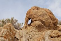
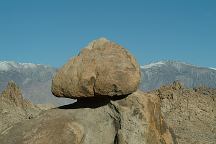
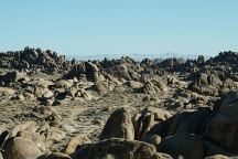
Besides natural arches and windows, there are several balanced rocks. Alabama
Hills were named in the 1860's during the Civil War by Southern
sympathizers in honor of the Confederate warship CSS Alabama. The
Alabama Hills Recreation Area was dedicated in 1969 by Bureau of Land
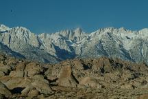
Management and encompasses almost 30,000 acres. Incredible views of the Sierra Nevada
Mountains, including Mount Whitney, the highest point in the contiguous United States. MORE PHOTOS OF
ALABAMA HILLS
Photos included on the free campground directory for Alabama Hills Recreation Area.
DIRECTIONS: ROAD CONDITIONS MILEAGE CHART: LINKS:
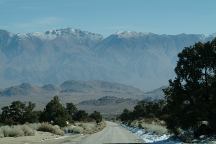
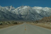
Whitney Portal Road towards Lone Pine, CA
Alabama Hills in the Valley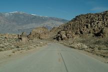
Whitney Portal Road towards Big Pine, CA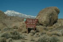
Sign at Alabama Hills Recreation Area
From Lone Pine, CA / Hwy.395
(At the only stop light in town)
Turn west on Whitney Portal Road
Whitney Portal Road is paved.
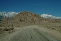
Movie Road is maintained dirt
surface with washboards.
Mileage from Lone Pine, CA
Big Pine 40 miles
Bishop 54 miles
Reno, Nevada xx miles
Los Angeles, CA xx miles
Death Valley 103 miles
Death Valley National Park is about 50 miles.
http://users.sisna.com/archman/AlabamaHills.html
Bob's Arches has extensive list of arches with photos and information.
MORE PHOTOS OF
ALABAMA HILLS MOVIES FILMED IN ALABAMA
HILLS MOVIE LOCATIONS
IN ALABAMA HILLS INDIAN GRINDING
STONES AND MORTARS FLOWERS OF THE ALABAMA
HILLS ARCHES OF
RED ROCK CANYON CHIDAGO
CANYON PETROGLYPHS DEATH
VALLEY NATIONAL PARK KEELER,
CALIFORNIA CAMPGROUND INDEX
dispersedcampgrounds.com
Photos included on the free campground directory for Alabama Hills Recreation Area.
Several movies have been filmed in this area, including Gunga Din, The Lone Ranger, ect...
Locations of movies filmed in the Alabama Hills. Locations have been
matched with images from the movie. Directions to help find the
locations. Included are GPS coordinates and satellite photos.
You can find several Indian Mortars in the Alabama Hills and surrounding area.
Flower photos from the Alabama Hills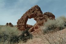
Arch 29.426 in Red Rock Canyon
Red Rock Canyon near Bishop, CA
Petroglyphs not shown on most maps.
Southeast from Red Rock Canyon. There are several more petroglyph sites in this section.
Photos and information about Death Valley.
Includes free Campground Directory.
Death Valley National Park is about
50 miles east from Lone Pine, CA
Photos from Keeler.
Located on Hwy.136
13 miles east from Lone Pine, CA
What a bizarre town... a complete subculture. Included under the listing for Ghost Towns.
Complete free campground listing
California Tourist Guide and Destinations
Things to do and see in California
ALABAMA HILLS RECREATION AREA
NATURAL ARCHES

