Free Campgrounds in the USAwww.eugenecarsey.com

Free camping and campgrounds
ARIZONA CAMPGROUND DIRECTORY
WINDY POINT CAMP RECREATION SITE
PACKSADDLE CAMP RECREATION SITE
LATITUDE: N 35°26.188
LONGITUDE: W 114°09.603
(GPS from the self-serve pay station)
Elevation: 6120'
Dispersed and Primitive Camping

Windy Point Campground
Elevations above 6000'

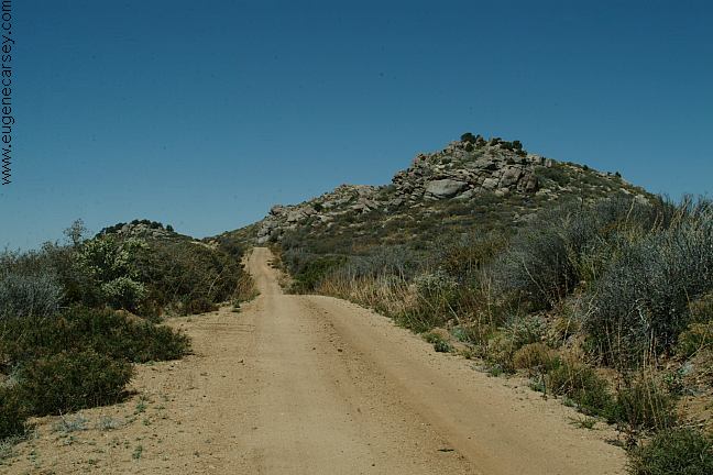
The road winds it's way up the side of
the mountains... narrow and steep upgrades
as you drive towards the sky. Campground
located on top of the Cerbat Mountains with
views that last forever. Above panorama
image is the actual view from the campground.

Big Wash Road
Big Wash Road

Windy Point Campground

Windy Point Campground

Windy Point Campground
LATITUDE: N 35°26.123
LONGITUDE: W 114°09.676
(This was our campsite)

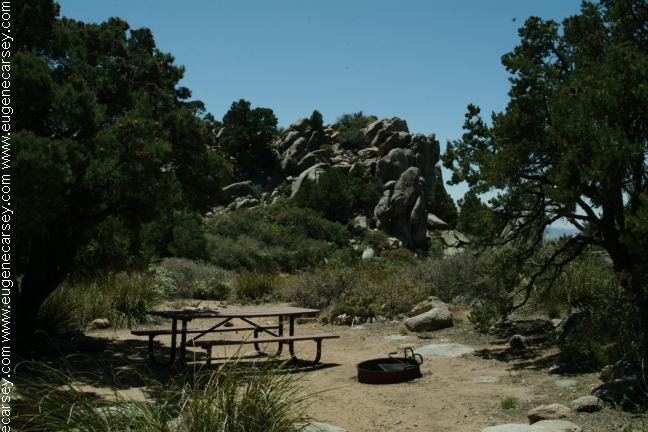
WINDY POINT CAMPGROUND
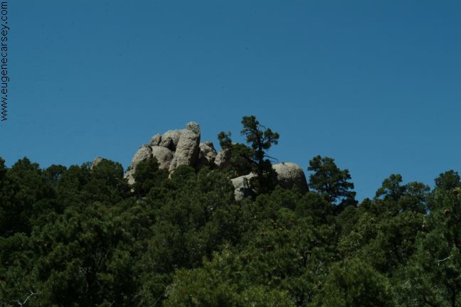
Windy Point Campground is a fee area.
Cost $4 with picnic tables, metal firerings,
garbage and vaulted toilets. There are
7 campsites throughout the rocks and
trees. It was worth the fee and plan to
stay here again.

Packsaddle Camp
Packsaddle Camp

Packsaddle Camp
Packsaddle Camp

PACKSADDLE CAMP
LATITUDE: N 35°27.141
LONGITUDE: W 114°10.205
Packsaddle Camp is a free tent site.
Picnic tables, firerings, garbage and
vaulted toilets. There are four walk-in
tent sites. Includes leveled tent pads.

CHERUM PEAK TRAIL
Arizona State Trail System includes
over 600 trails.

Dispersed Campsite on Big Wash Road
LATITUDE: N 35°27.552
LONGITUDE: W 114°13.287
(4 miles from Jct. of Hwy.93)

There were several free dispersed campsites
along Big Wash Road. Most are too close
to the road and would get dusted out by
passing cars. We have seen RVs parked
in these areas, but it is kind of a tight
squeeze.

Big Wash Road
Big Wash Road

Birds, rabbits, snakes and lizards...
Cactus, pine and juniper trees with some
flowers adding color to the landscape.

MINE SHAFT AREA
From the Cherum Peak Trailhead you
can see the tailings from old mine shafts.
The mine shafts are holes in the ground
that can be over 100' straight down. The
ground around some of the mine shafts
are covered with loose gravel and easy
to lose your footing.

There is an old grave site covered with
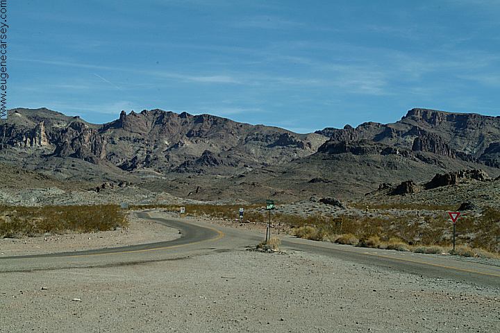
stones. When we got near the grave, a
couple big ravens started flying overhead
and screeching like crazy. As soon as we
walked away, they flew off into the horizon.
That was strange...

DIRECTIONS:
From Kingman, AZ
Take Hwy.93 north 20 miles / MP 51
Turn east on Big Wash Road.

From Las Vegas take Hwy.93 south 82 miles.
Turn east on Big Wash Road.

DISTANCE FROM HIGHWAY 93
and BIG WASH ROAD

Packsaddle Rec. Site
Windy Point Rec. Site
Cherum Peak Trailhead

Kingman
Las Vegas

9
11
12

20
82

ROAD CONDITIONS:
The road is rough and narrow with
steep grades. The entrance at Windy
Point Recreation Site narrowly passes
between two large boulders with only
10' clearance and there happens to be
a big rut in the road. RV's and wide
vehicles could have trouble, but if
your crazy enough to drive this far.
RVs and trailers not recommended.

Windy Point Campground
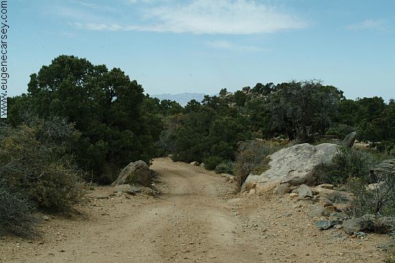
Entrance to Windy Point Campground
Notice the two boulders with 10' width

MAP

Nearest BLM Office
Kingman 928-718-3700
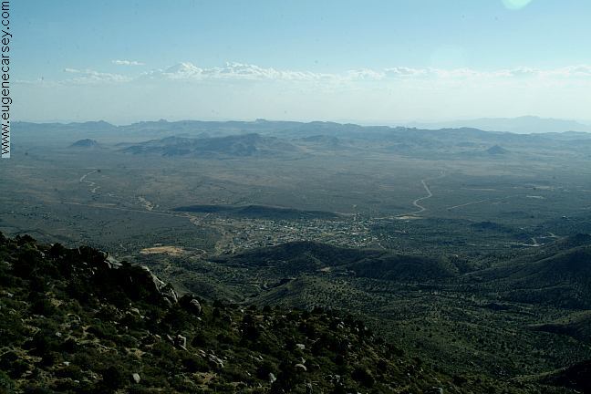
Chloride Arizona
Chloride Arizona

Chloride Arizona is an old mining town.
Nice people and worth to check it out.
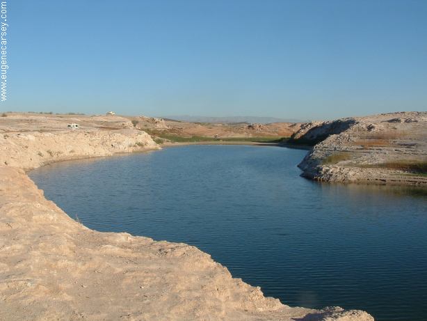
Bonelli Bay
Bonelli Bay

BONELLI BAY
Simple and relaxing.
LATITUDE: N 36°03.750
LONGITUDE: W 114°28.532
Camp along the shore of Lake Mead.
Enjoy walking the shores of Lake Mead
and this is about wild and crazy as it gets...

Bonelli Bay
Bonelli Landing

BONELLI LANDING
Same area as Bonelli Bay
LATITUDE: N 36°05.004
LONGITUDE: W 114°29.106
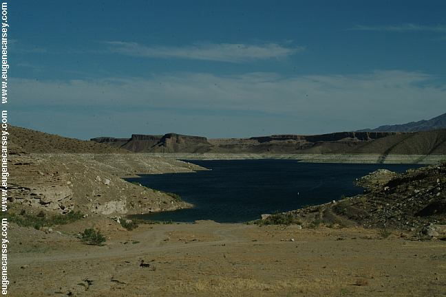
Greg's Hideout Camping Area
Greg's Hideout

GREG'S HIDEOUT
Primitive camp area on Lake Mead
LATITUDE: N 36°00.072
LONGITUDE: W 114°13.861

Pearce Ferry Crossing

PEARCE FERRY
LATITUDE: N 36°07.000
LONGITUDE: W 114°00.256

Showers at Temple Bar
25 cents for two minutes
Look for the laundry building
(Hidden behind the cottages)

Lake Mead Recreation Area
Government Wash and Lake Mead

Joshua Tree Forest
Joshua Tree Forest - Grand Wash Cliffs

Also see: ALAMO LAKE
Also see:
BONELLI LANDING
Also see:
CIBOLA / COLORADO RIVER
Also see:
COLORADO DESERT
Also see:
CRAGGY WASH
Also see:
CRYSTAL HILL
Also see:
DEATH VALLEY
Also see:
DOME ROCK MOUNTAIN
Also see:
GOVERNMENT WASH
Also see:
GREG'S HIDEOUT
Also see:
JOSHUA TREE
Also see:
LAKE HAVASU
Also see:
LAVA POINT
Also see:
MESA ROAD
Also see:
MOJAVE DESERT
Also see:
NEEDLE MOUNTAINS
Also see:
OSBORNE WASH
Also see:
PALM CANYON
Also see:
PALO VERDE
Also see:
PLOMOSA ROAD
Also see:
SCADDAN WASH
Also see:
SWANSEA TOWNSITE
Also see:
TRONA PINNACLES
Also see:
WAGON WHEEL
Also see: WILD COW SPRINGS

Historic Route 66 towards Oatman
Historic Route 66 near Oatman, Arizona
Junction of Boundary Cone Road

UFO House in Yucca Arizonia
UFO House on Alamo Road
Alamo Road in Yucca, Arizona
Interstate 40 at Exit#25

We guess they landed here from another
planet and decided to stay. There are
several spaceships in the yard.

CAMPGROUND INDEX
Complete free campground listing

CAMPING ADVICE AND TIPS

TOURIST PHOTOS

Camped here May 3, 2006

Copyright Notice
www.eugenecarsey.com

dispersedcampgrounds.com
Free campgrounds and camping
ARIZONA CAMPGROUND DIRECTORY
PACKSADDLE CAMP RECREATION SITE
WINDY POINT CAMP RECREATION SITE