|
Hot, dry and dusty... just plain miserable...
is a good description of the Colorado Desert.
Mostly the Colorado Desert is public land and
you can camp anywhere.
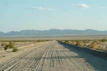
Rice-Midland Road
The town of Rice is just a couple old
buildings,
a fence covered with tennis shoes, and what
appeared to be a gas station that had long
since burned down leaving just a outline
of the original building.
Midland is an old mining town. No
trespassing...
mine shafts and other extreme dangers await
for those foolish enough to ignore the signs.
You can see foundations from the old buildings.
There are several RVs and trailers parked out
here... not sure what the deal is...
Between Rice and Midland there are limited
camping areas where you can safely pull off
the road. The area north and south of Midland
are some camping areas. On Arlington Mine
Road and Patton's Cabin are some areas to
hideout.
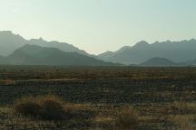
Road north from Midland at 6am
Routes to Explore
- Rice Valley Dunes
- Rice-Midland Road
- Powerline Road
- Midland-Vidal Road
- Blythe-Vidal Road
- Rice Valley Road
- Seven Washes Road
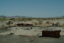
Arlington Road
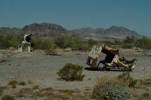
Arlington Road
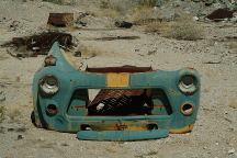
Arlington Road
About a mile down Arlington Road is an
old building foundation and dump area.
Old cars scattered about made some
funny photos.
DIRECTIONS:
From Twentynine Palms, CA
Take Hwy 62 east to Rice.
Go south on Rice-Midland Road.
From Parker, Arizona
Take Hwy 62 west to Rice.
Go south on Rice-Midland Road.
From Blythe go north...
MAP
The road between Rice and Midland
is rough with areas of loose sand.
Passenger cars can make it, but is
a risky and tension filled drive. Keep
both hands on the steering wheel and
bring a tow rope. Water, oil and spare
parts are the rules of the desert.
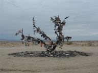
Tree covered with shoes... then set on fire.
Tree covered with shoes... then set on fire.
This was a work of art in the middle of the
desert. The tree was not approved and shortly
cut down. There is no evidence left that it even
existed, with the exception of a couple photos.
The desert can be harsh and unforgiving to
someone without proper emergency equipment.
Knowledge of the area, weather, route, and
limitations of you and your equipment, plus
a little common sense, can ensure a safe and
enjoyable trip.
For more information contact
the nearest BLM Office.
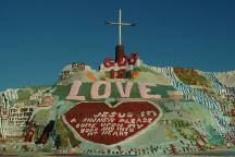
Salvation Mountain
SALVATION MOUNTAIN
Leonard Knight's Salvation Mountain
Take Hwy.111 south to Niland, CA
|


