http://www.dispersedcampgrounds.comhttp://www.eugenecarsey.com

Free camping and campgrounds
OREGON CAMPGROUND DIRECTORY
MOUNT HOOD NATIONAL FOREST
HIGHWAY 224
Dispersed and Primitive Camping

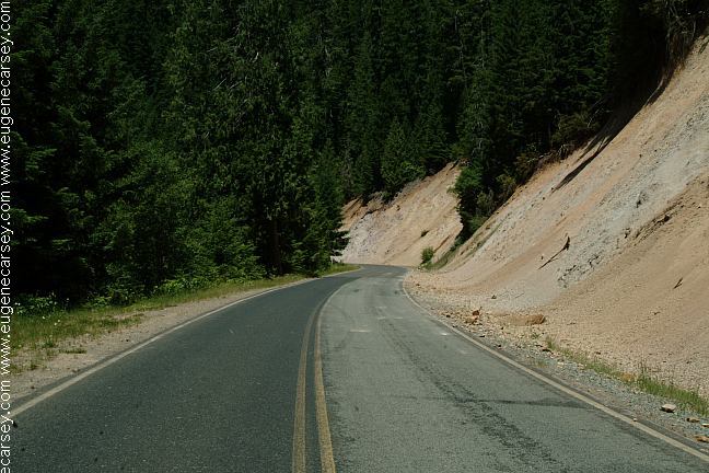
Hwy 224 and Road#46 from Estacada to
Detroit is apx. 70 miles in length with dispersed
camp sites along the way. There are very few
cars on this road that winds and twist it's way
through the Cascade Mountain Ranges in
Mount Hood National Forest.

Starting from Estacada on Hwy.224
NOTE This is only a partial list.
Mount Hood National Forest boundary
is about 7 1/2 miles west from Estacada
It is easy to find a good camp...
No services for the next 70 miles.

ROAD#45 / MIDDLE ROSE ROAD
9 miles east of Estacada
(Between milepost 33-34?)
You will see the steel bridge and on the
other side is nice camp area. It is best with
a tent, as you can set up in the trees along
the river's bank.

Mount Hood from Fish Creek Road
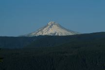
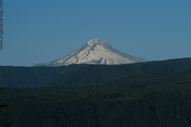
Mount Hood from Fish Creek Road #49

Mount Hood is the tallest peak in Oregon
11,239'

FISH CREEK ROAD #49
Between Milepost 40-39
Paved single lane road with upgrades
Some camps the first three miles.
The road continues about 6 more miles
Views of Mount Hood near the top.

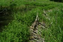
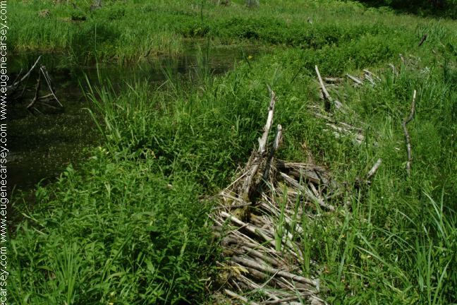
Old Beaver Dam on Road#4620

ROAD#4620
Milepost 46
Indian Henry Campground is about a mile.
Continue up the road and there are some
beaver dams in a couple miles. One dam
was old and covered with moss. Now the
area looks like a swamp. You can still see
tree stumps from where beavers harvested
the trees, leaving behind classic teeth marks.
You can find some places to camp.

Another great camp is Road #262
1/5 mile east of Road #57 / Rainbow Campground.
Road #262 is only about 1/8 mile with camps areas.
There are trails through the moss covered forest that
lead to the river. Makes a good hideout from the rest
of the world

About 34 miles from Estacada are some
hot springs and a campground along the
river's banks. It is always crowded...

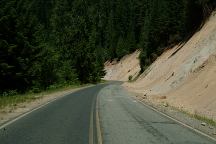
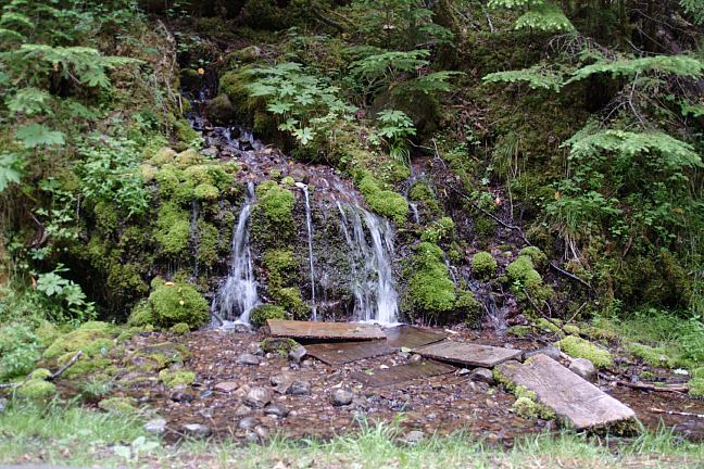
Road#46 Pumice Cliffs

ROAD#46
Highway 224 turns into Road#46
Apx. 26 miles west of Estacada near
Ripplebrook G.S. at milepost 50

ROAD#63
Bagby Hot Springs Trailhead
and Little Fan Campground.
40 miles north of Detroit.
30 miles south of Estacada.

ROAD#4670
(Road#46 near milepost 29)
Take Road#4670 about 1/4 mile and
before the bridge there is a great camp.
Somebody hand built a classic style bench.
The river fills the air with natural music.
Continue across the bridge and to the right
are more camp areas.

OLALLIE SCENIC AREA
Skyline Road / Road#4220
Road#46 near milepost 23 take Road#4690
for 6 miles to Road#4220.

MORE ESTABLISHED CAMPGROUNDS
Below campgrounds are in Mount Hood NF
If you park or occupy a site for any reason,
you must pay it... a lot of rules and conditions.
LAZY BEND CAMPGROUND
(Near milepost 35 / between 34-35)
BIG EDDY PICNIC AREA
(Between milepost 37-38)
CARTER BRIDGE CAMPGROUND $14
(Between milepost 38-39)
Day use area with garbage across the road
Whitewater information across bridge
LOCKABY CAMPGROUND
(Milepost 39)
ARMSTRONG CAMPGROUND
(Milepost 39)
FISH CREEK CAMPGROUND
(Milepost 39-40)
Turn on Fish Creek Road / Road#49
ROARING RIVER CAMPGROUND
(Milepost 42)
SUNSTRIP CAMPGROUND
(Milepost 42)
INDIAN HENRY CAMPGROUND
(Milepost 46)
Road#4620
ALDER FLAT CAMPGROUND
(Milepost 49)
RIPPLEBROOK CAMPGROUND $14
(Near milepost 50)
RAINBOW CAMPGROUND
(Milepost 50)
RIVERSIDE CAMPGROUND $14
(Milepost 50?)
At the junction of Road#57 to Timothy Lake
Hwy.224 becomes Road#46
You must pay
Even you get a flat tire, if you don't pay,
you will go to jail. We don't like public
campgrounds run by private companies.

DIRECTIONS:
From Portland take I-205 South
Exit on Hwy.224 towards Estacada
Estacada is at milepost 24
A couple miles past Estacada are good camps.
From Detroit
Turn just before the bridge(West of town)
The sign says National Forest Road #46.
Continue on Road#46 for apx. 43 miles
Road#46 becomes Hwy.224 near Ripplebrook.

Showers at Detroit Lake State Park.
Cost $2.00

Best water at Humbug Campground
(4 miles from Junction of Hwy.22)
Natural mountain spring on Road#4670
A couple hundred yards from the junction
of Road#46. The water is clean and refreshing.

Natural mountain spring
Natural Mountain Spring on Road#4670

Also see: COVE CREEK
Also see:
GREEN PETER LAKE
Also see:
JACK LAKE ROAD
Also see:
OLALLIE SCENIC AREA
Also see:
ROAD#46
Also see:
ROAD#4670
Also see:
ROAD #63

Google Custom Map Free Oregon Campgrounds
Google Custom Map by Ian

OREGON FREE CAMPGROUND MAP
Google custom map by Ian with most of the
free campgrounds in Oregon
.

Burned vehicle at Olallie Lake
Burned vehicle at Olallie Lake - July 2006

Burned vehicle
Burned vehicle on Road#4670 - July 2006

Burned vehicles are common sights in
the last couple years. Presume they were
stolen and stripped of parts, then burned
any evidence....

CAMPGROUND INDEX
Complete free campground listing

CAMPING ADVICE AND TIPS

TOURIST PHOTOS

Mount Tabor
Mount Tabor in Portland, OR
Entrance from 60th St. and Salmon

Copyright Notice
www.eugenecarsey.com

dispersedcampgrounds.com
Free camping and campgrounds
OREGON CAMPGROUND DIRECTORY
HIGHWAY 224
MOUNT HOOD NATIONAL FOREST