|
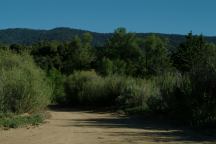
Ozena Campground
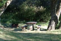
Ozena Campground
Ozena Campground is nice...
Road 9N03
Picnic tables, metal firerings, and outhouse.
Small campground with campsites scattered
throughout the trees. It is relaxing and there
are shaded areas to escape the summer heat.
You can hear the traffic on Lockwood Valley
Road... but there's not too many cars.
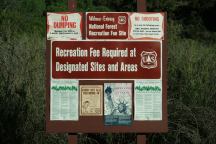
Ozena Campground Information Board
Not sure about the Recreation Fee... see sign
above.
There are no fee schedules or information. Most of the
campgrounds in this area require a Forest Recreation
Pass.
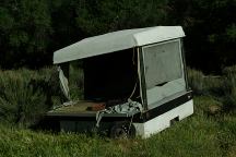
Looks suspicious... must have been stolen.
There are several campgrounds in the area.
Below is a list with descriptions...
Dome Springs Campground
DOME SPRINGS CAMPGROUND
Dome Springs Campground is a couple
miles east on Lockwood Valley Road.
REYES CREEK CAMPGROUND
A couple miles east on Lockwood Valley
Road. Good fishing and nice people.
REYES PEAK
CAMPGROUND
Not too far... take Hwy.33 south.
This campground touches the sky...
This is one of our favorite campgrounds.
The road to Reyes Peak Campground
is narrow with steep upgrades.
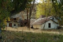
Old house on Lockwood Valley Road
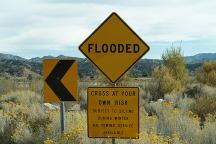
Lockwood Valley Road
(West from Ozena C.G.)
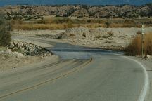
Lockwood Valley Road
(West from Ozena C.G.)
ROAD 7N03
|
Pine Springs Campground
Snedden Campground
Halfmoon Campground
Grade Valley
Matau Flats
|
5
11
12
8
14
|
This road is always closed??? Mostly we have
been here during the winter months, figured
it's a seasonal thing... but it is also closed this
summer for maintenance... no trespassing...
DO NOT ENTER!
UPDATE:
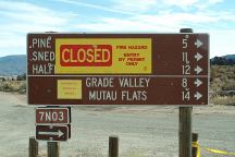
Road#7N03 closed due to forest fire...
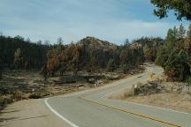
Forest fire on Lockwood Valley Road
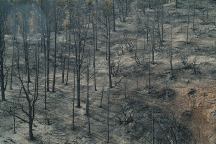
Forest fire on Lockwood Valley Road
DIRECTIONS:
From I-5 exit at Frazier/ Mount Pinos Rec. Area.
Turn on Lockwood Valley Road.
You will see the sign for Ozena Campground.
About 1/4 miles of dirt road
From Hwy.33
Take Lockwood Valley Road east 1.5 miles.
There is a sign for Ozena Campground.
NOTICE: Lockwood Valley Road may be
impassible during rain or snow conditions.
MAP
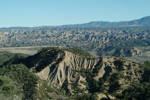
Highway 33
South of Lockwood Valley Road
MILEAGE CHART FROM JUNCTION OF
HWY.33 AND LOCKWOOD VALLEY ROAD
|
Going east on
Lockwood Valley
|
Lockwood Valley
Interstate 5
|
18 miles
35 miles
|
|
Going south on
Highway 33
|
Ojai
Ventura
|
37 miles
49 miles
|
|
Going north on
Highway 33
|
Maricopa
Taft
|
35 miles
43 miles
|
|


